
- elevation 292 ft (89 m) Basin area 70.97 km² | - elevation 1,220 ft (372 m) Length 22 km Basin area 70.97 km² | |
 | ||
- left Black Run (Paxton Creek) Bridges Mulberry Street Bridge, State Street Bridge | ||
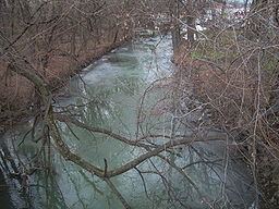
Paxton Creek is a 13.9-mile-long (22.4 km) tributary of the Susquehanna River in Dauphin County, Pennsylvania in the United States.
Contents
Map of Paxton Creek, Harrisburg, PA, USA
The Paxton Creek watershed covers an area of 27.4 square miles (71 km2) and joins the Susquehanna River at South Harrisburg, Harrisburg.
The name Paxton, or Paxtang, is derived the Susquehannock term "Peshtank", meaning "where the waters stand" or "the place of springs". It is born from two branches on the southern slopes of Blue Mountain to form the main stem in Lower Paxton Township. It then forms Wildwood Lake in Susquehanna Township, it becomes a concrete channel downstream at Harrisburg to mitigate urban runoff and flooding.
References
Paxton Creek Wikipedia(Text) CC BY-SA