
OS grid reference SJ759166 Post town NEWPORT Dialling code 01952 | Sovereign state United Kingdom Postcode district TF10 | |
 | ||
Civil parish Chetwynd Aston and Woodcote | ||
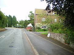
Pave Lane is a hamlet in the Telford and Wrekin district of Shropshire, approximately 1.5 miles (2.4 km) south of the centre of the market town of Newport, just outside the small village of Chetwynd Aston.
Contents
Map of Pave Lane, Newport, UK
There is a large public house in Pave Lane — "The Fox".
History
Because of its location on a toll road between Newport and Wolverhampton, which became the A41, the area became the site of many inns and coach houses.
By 1767 it had become the site of a small lime works and brick works owned by local landlord Lord Gower, who made Pave Lane the terminus of Donnington Wood Canal. Limestone and coal was sold at the wharf at Pave Street and supplied the growing town of Newport with coal. The rise of railways and carriages meant the canal went into decline and the Pave Lane stretch of the canal closed in 1882; the canal has since been filled in.
The A41 road no longer runs through Pave Lane, instead it now passes on a new alignment just to the east of Pave Lane and Chetwynd Aston.
Notable people
Leader of the Labour Party, Jeremy Corbyn, and his brother Piers Corbyn, the weather forecaster, lived from childhood at Pave Lane until after leaving school, in the former Yew Tree Guesthouse which their father had bought and converted to a family home. It appears on Ordnance Survey maps today as Yew Tree Manor.