
Country United States GNIS feature ID 489796 Zip code 40863 Area code 606 | Time zone Eastern (EST) (UTC-5) Elevation 378 m Population 379 (2010) | |
 | ||
Weather 11°C, Wind NW at 2 km/h, 50% Humidity Area 3.245 km² (3.219 km² Land / 3 ha Water) | ||
How to say or pronounce usa cities pathfork kentucky
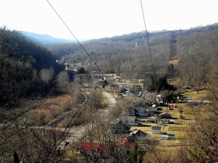
Pathfork is an unincorporated community and census-designated place (CDP) in Harlan County, Kentucky, United States, located to the south bank of Wallins Creek. Its population was 379 as of the 2010 census. The city's main roads are East Hwy 72, which connects from US 119, and travels to an end at Old RB Mines, however, 72 runs to Harlan via gravel road,and Ky 2005 an old gravel road that leads to Smith/Brownes Creek, south of Harlan, Kentucky.
Contents
Overview
The town used to rely heavily on coal mining. But many coal mines now have been shut down causing a reduction in the production of coal. The recent recession in the coal market brought about by over regulation of the E.P.A., has caused high unemployment rates in this small town as well as Harlan County, Kentucky and throughout the United States.
A small community park, known as Coal Miner's Memorial Park, was created to honor the community's ties to coal mining.There are four churches in the town: Insull Holiness, Pathfork Holiness Church, Pathfork Baptist and Blackstar Pentecostal Church.