
Team Paro United F.C. | ||
 | ||
Points of interest Paro Taktsang, Rinpung Dzong, Drukgyal Dzong, Kichu Lhakang, National Museum of Bhutan | ||
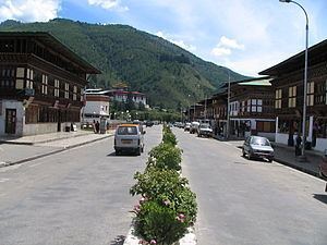
Paro District (Dzongkha: སྤ་རོ་རྫོང་ཁག་; Wylie: Spa-ro rdzong-khag) is a district (dzongkhag), valley, river and town (population 20,000) in Bhutan. It is one of the most historic valleys in Bhutan. Both trade goods and invading Tibetans came over the pass at the head of the valley, giving Paro the closest cultural connection with Tibet of any Bhutanese district. The dominant language in Paro is Dzongkha, the national language.
Contents
- Map of Paro Bhutan
- Geography
- Administrative divisions
- Environment
- Cultural sites
- Economy
- Paro Indian Military Base
- References
Map of Paro, Bhutan
Paro contains the only international airport in Bhutan, Paro Airport.
Geography
Paro District is bordered by Haa District to the west, Tibet to the north, Thimphu District to the east, and Chukha District to the south.
Administrative divisions
Paro Districts comprises ten village blocks (or gewogs):
Environment
Northern Paro District (the gewogs of Doteng and Tsento) contains part of Jigme Dorji National Park and the biological corridor connecting it to Torsa Strict Nature Reserve in neighboring Haa District.
Cultural sites
Important cultural sites of Paro include:
Economy
Druk Air, the national airline of Bhutan, has its headquarters in Paro.
Paro Indian Military Base
Paro is the Indian Army's second military base outside its territory, the first one being Farkhor Air Base in Tajikistan where India also renovated but did not occupy the Ayni Air Base.