
 | ||
Paris basin agriculture
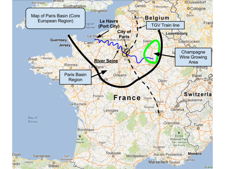
The Paris Basin is one of the major geological regions of France having developed since the Triassic on a basement formed by the Variscan orogeny. The sedimentary basin is a large sag in the craton, bordered by the Armorican Massif to the west, the Ardennes-Brabant axis to the north, the Massif des Vosges to the east, and the Massif Central to the south.
Contents
Paris basin manufacturing
Extent
The region usually regarded as the Paris Basin is rather smaller than the area formed by the geological structure. The former occupies the centre of the northern half of the country, excluding Eastern France. The latter extends from the hills just south of Calais to Poitiers and from Caen to the brink of the middle Rhine Valley, east of Saarbrücken.
Geography
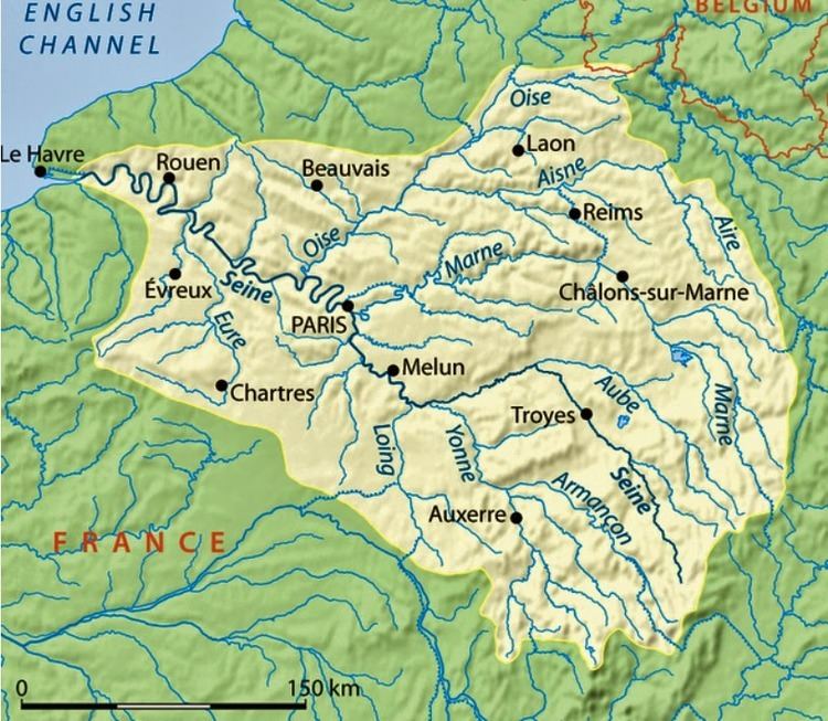
The countryside is one of plains and plateaux of limited altitude. In the south-east and east the plain of Champagne and the Seuil de Bourgogne (Threshold of Burgundy) differential erosion of the strata has left low scarps with the dip slopes towards the centre. The varying nature of the clays, limestones and chalk gives rise to the characteristics of the regions such as Champagne Humide (Damp Champagne), Champagne Pouilleuse (poor Champagne), the Pays de Caux and the Pays de Bray. Map missing
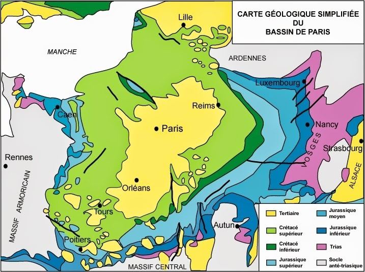
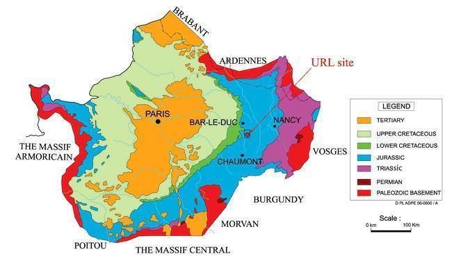
Structure
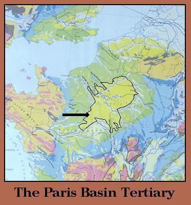
The Paris Basin is a geological basin of sedimentary rocks. It overlies geological strata disturbed by the Variscan orogeny and forms a broad shallow bowl in which successive marine deposits from throughout periods from the Triassic to the Pliocene were laid down, their extent generally diminishing with time. Based on analysis of fossils recognized in the Paris Basin strata during the 1820s and 1830s, the pioneering geologist Charles Lyell divided the Tertiary into three ages he named the Pliocene, the Miocene and the Eocene. .
To the west, the strata folded by the Variscan rise from below the more recent marine deposits in the hills of Brittany and, to the east, the Ardennes, Hunsrück and Vosges. To the south, it borders on the Massif Central and the Morvan. To the north, its strata link into those of the bed of the English Channel and south-eastern England. Other boundaries lie on ridges in more recent deposits and scarps such as the Côte d'Or (on an Alpine fault line) and the Hills of Artois which overlie the margin of London-Brabant Massif.
Oil Fields
Two large oil fields are located in the basin, one is the Chaunoy Field, the other is the Villeperdue Field, discovered in c limestone]] 1850 m deep.