
Time zone ART (UTC-3) | Local time Wednesday 6:35 PM | |
 | ||
Weather 28°C, Wind E at 18 km/h, 74% Humidity Points of interest Fort Zeelandia, Paramaribo Zoo, Central Suriname Nature R, Surinaams Museum, Jules Wijdenbosch Bridge | ||
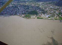
Paramaribo is a district of Suriname, encompassing the city of Paramaribo and the surrounding area.
Contents
Map of Paramaribo District, Suriname
Paramaribo district has a population of 240,924, almost half the population of the entire country, and an area of 182 km².
The area was first colonised by the British in the 17th century with the construction of Fort Willoughby. This fort was later taken by the Netherlands and renamed Fort Zeelandia. The area, and the city of Paramaribo, switched between Dutch and British control until the Treaty of Breda at the end of the Second Anglo-Dutch War ceded all of Suriname to the Dutch.
Resorts
Paramaribo is divided into 14 resorts (ressorten):
References
Paramaribo District Wikipedia(Text) CC BY-SA