
Area 178.7 km² | Time zone MUT (UTC+4) Population 139,966 (2015) | |
 | ||
Points of interest Sir Seewoosagur Ramgool, Blue Safari grand bay, L'Aventure du Sucre, Maheswarnath Mandir, Mont Choisy Beach Destinations Port Louis, Grand‑Baie, Trou‑aux‑Biches, Balaclava, Pointe‑aux‑Piments | ||
Pamplemousses is a district of Mauritius, located in the north west of the island, and is one of the most densely populated parts of the island. The name of the district comes from the French word for grapefruits. The district has an area of 178.7 km2 and the population estimate was at 139,966 as of 31 December 2015.
Contents
Map of Pamplemousses District, Mauritius
Places of interest
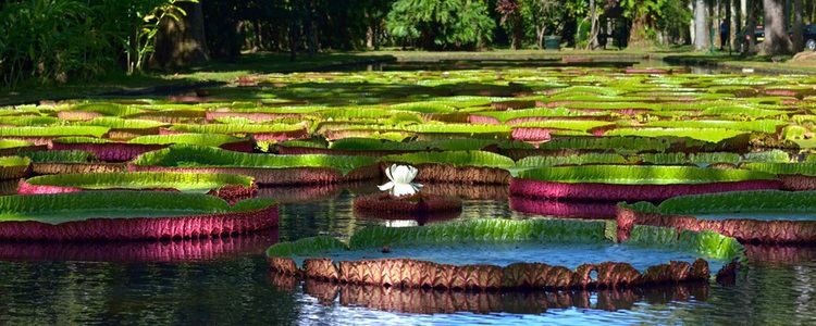
The district hosts the SSR botanical garden, or Jardin Botanique Sir Seewoosagur Ramgoolam, renamed in 1988 in honor of the first prime minister of Mauritius. The garden was first constructed by Pierre Poivre (1719–1786) in 1770. The area is 25 hectares. The garden features spices, ebonies, sugar canes and many more. It also features lotuses as well as 85 varieties of palms from Central America, Asia, Africa and the islands around the Indian Ocean. The district is the home of the Pamplemousses SC local football team.
Places
The Pamplemousses District include different regions; however, some regions are further divided into different suburbs.