Girish Mahajan (Editor)

Palmyra Township, Douglas County, Kansas

Updated on
Edit
Like
Comment
Share on FacebookTweet on TwitterShare on LinkedInShare on Reddit
Country
  
United States

County
  
Douglas

GNIS feature ID
  
0479537

Local time
  
Tuesday 9:52 AM

State
  
Kansas

Elevation
  
1,050 ft (320 m)

Population
  
5,760 (2000)

University
  
Baker University

Palmyra Township, Douglas County, Kansas httpsuploadwikimediaorgwikipediaenthumb0

Weather
  
11°C, Wind NE at 23 km/h, 59% Humidity

Points of interest
  
Old Castle Museum, White Tail Run Winery & Vineyard, Stony Point Evangelical Lutheran Church

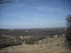
Palmyra Township is a township in Douglas County, Kansas, USA. As of the 2000 census, its population was 5,760. It was named after a small trail stop on the Santa Fe Trail that was later absorbed into Baldwin City. When it was first established in 1855, it was called Calhoun, until 1858.

Contents

Map of Palmyra, KS, USA

Geography

Palmyra Township covers an area of 82.57 square miles (213.9 km2) and contains one incorporated settlement, Baldwin City. According to the USGS, it contains six cemeteries: Baldwin City, Brumbaugh, Oakwood, Old Black Jack, Prairie City and Vinland.

The stream of Wymore Creek runs through this township.

Adjacent townships

  • Wakarusa Township, Douglas County (northwest)
  • Eudora Township, Douglas County (northeast)
  • McCamish Township, Johnson County (east)
  • Richland Township, Miami County (southeast)
  • Franklin Township, Franklin County (south)
  • Hayes Township, Franklin County (southwest)
  • Willow Springs Township, Douglas County (west)
  • Towns and settlements

    Although these towns may not be incorporated or populated, they are still placed on maps produced by the county.

  • Baldwin City, located at 38°46′39″N 95°11′15″W
  • Black Jack, located at 38°45′50″N 95°07′36″W
  • Brooklyn, located at 38°49′06″N 95°14′29″W
  • Clearfield, located at 38°49′33″N 95°05′35″W
  • Prairie City, located at 38°46′03″N 95°12′35″W
  • Vinland, located at 38°50′22″N 95°10′56″W
  • Major highways

  • U.S. Highway 56
  • K-33
  • Airports

    Palmyra Township contains one airport or landing strip, Vinland Valley Aerodrome.

    Places of interest

  • Douglas State Fishing Lake northeast of Baldwin City has fishing, hunting and limited camping.
  • Signal Oak, a hill north of Baldwin where a tall oak tree once stood that was used to warn Lawrence about approaching guerrilla attacks during the American Civil War. The tree is gone but is clearly marked and has a scenic view of the Coal Creek, Wakarusa and Kaw Valleys.
  • Spring Lake, a small fishing and recreation lake southeast of Baldwin offer scenic views, fishing and hiking trails.
  • Ivan Boyd Prairie Preserve and Robert Pearson Memorial Park, located east of Baldwin marks wagon ruts along the Santa Fe Trail and the Battle of Black Jack which some consider the first battle of the Civil War.
  • References

    Palmyra Township, Douglas County, Kansas Wikipedia