
Website douglascountyks.org Founded 25 August 1855 | Area 1,230 km² Population 114,322 (2013) | |
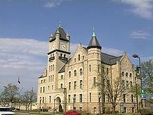 | ||
Colleges and Universities University of Kansas, Haskell Indian Nations U, Baker University, Pinnacle Career Institute, WellSpring School of Allied He Points of interest | ||
Douglas County (county code DG) is a county located in the U.S. state of Kansas. As of the 2010 census, the county population was 110,826, making it the fifth-most populous county in Kansas. Its county seat and most populous city is Lawrence.
Contents
- Map of Douglas County KS USA
- Early history
- 19th century
- Geography
- Adjacent counties
- Demographics
- Government
- Major highways
- County Highways
- Unified school districts
- Universities and colleges
- Parks
- Events
- Incorporated cities
- Townships
- Historic Townships
- Notable people
- References
Map of Douglas County, KS, USA
Early history
For many millennia, the Great Plains of North America was inhabited by nomadic Native Americans. From the 16th century to 18th century, the Kingdom of France claimed ownership of large parts of North America. In 1762, after the French and Indian War, France secretly ceded New France to Spain, per the Treaty of Fontainebleau.
19th century
In 1802, Spain returned most of the land to France, but keeping title to about 7,500 square miles. In 1803, most of the land for modern day Kansas was acquired by the United States from France as part of the 828,000 square mile Louisiana Purchase for 2.83 cents per acre.
In 1854, the Kansas Territory was organized, then in 1861 Kansas became the 34th U.S. state. In 1855, Douglas County was established. Douglas County was opened for settlement on May 15, 1854, and was named for Stephen A. Douglas, a senator from Illinois. The county was practically at the center of the Bleeding Kansas years as leaders in Lecompton, the territorial capital, wanted Kansas to be a slave state and leaders in Lawrence wanted Kansas to be a free state. Because of this, multiple events took place, including the drafting of the Lecompton Constitution admitting Kansas as a slave state, the sacking of Lawrence, and the Battle of Black Jack.
The first railroad in Douglas County, the Union Pacific, was built through that territory in 1864.
Geography
According to the U.S. Census Bureau, the county has a total area of 475 square miles (1,230 km2), of which 456 square miles (1,180 km2) is land and 19 square miles (49 km2) (4.0%) is water. It is the fifth-smallest county in Kansas by land area. Much of its northern boundary is defined by the Kansas River, which flows through Lawrence and provides hydropower at the Bowersock Dam.
Adjacent counties
Demographics
Douglas County comprises the Lawrence, KS Metropolitan Statistical Area, which is also included in the Kansas City-Overland Park-Kansas City, MO-KS Combined Statistical Area.
As of the 2000 census, there were 99,962 people, 38,486 households, and 21,167 families residing in the county. The population density was 219 people per square mile (84/km²). There were 40,250 housing units at an average density of 88 per square mile (34/km²). The racial makeup of the county was 86.1% White, 4.2% Black or African American, 2.6% Native American, 3.1% Asian, 0.1% Pacific Islander, 1.2% from other races, and 2.7% from two or more races. Hispanic or Latino of any race were 3.3% of the population.
There were 38,486 households out of which 27.4% had children under the age of 18 living with them, 43.1% were married couples living together, 8.5% had a female householder with no husband present, and 45.0% were non-families. 28.5% of all households were made up of individuals and 5.8% had someone living alone who was 65 years of age or older. The average household size was 2.37 and the average family size was 2.97.
In the county, the population was spread out with 20.4% under the age of 18, 26.4% from 18 to 24, 28.3% from 25 to 44, 16.9% from 45 to 64, and 7.9% who were 65 years of age or older. The median age was 27 years. For every 100 females there were 98.70 males. For every 100 females age 18 and over, there were 97.70 males.
The median income for a household in the county was $37,547, and the median income for a family was $53,991. Males had a median income of $35,577 versus $27,225 for females. The per capita income for the county was $19,952. About 6.2% of families and 15.9% of the population were below the poverty line, including 9.0% of those under age 18 and 7.3% of those age 65 or over.
Government
Douglas County is currently served by county commissioners Mike Gaughan, Nancy Thellman, and Jim Flory.
Democratic state representatives of the county include John Wilson (10th District), Barbara Ballard (44th District), and Dennis Highberger (46th District); Republican state representatives include Connie O'Brien (42nd District), Tom Sloan (45th District) and Ken Corbet (54th District). The three state senators representing the county, Marci Francisco (2nd District), Tom Holland (3rd District), and Anthony Hensley (19th District), are all Democrats.
Major highways
County Highways
Douglas County also maintains an extensive network of county highways to serve the rural areas of the county. None of these county highways is in the Lawrence city limits.
Unified school districts
Douglas County is served by seven school districts.
Universities and colleges
The University of Kansas's main campus is located in Lawrence as is Haskell Indian Nations University. Baker University, the state's oldest university, is located in Baldwin City.
Parks
Clinton Lake, completed in 1980, offers boating, fishing and other water sports and various parks surrounding the lake provides camping and trails for mountain biking, hiking and horseback riding.
Lone Star Lake is a small country lake to the southwest of Lawrence offers fishing, boating and camping. Just northwest of Baldwin City is Douglas State Fishing Lake which provides hunting, fishing and limited camping. Other parks around the county include Black Jack Park which includes the Ivan Boyd Prairie Preserve and Robert Hall Pearson Memorial Park, Broken Arrow Park in Lawrence and Wells Overlook Park just south of Lawrence.
Events
Major events in the county include the Maple Leaf Festival in Baldwin City every third full weekend in October. Lecompton's Territorial Days take place every year in June and Lawrence has many parades throughout the year including Christmas and St. Patrick's Day.
Incorporated cities
Townships
Douglas County is divided into nine townships. The city of Lawrence is considered governmentally independent and is excluded from the census figures for the townships. In the following table, the population center is the largest city (or cities) of significant size included in that township's population total.
Historic Townships
The county originally had only four townships. Lecompton comprised the area of Lecompton, Kanwaka, and Clinton townships; Washington took the place of Marion and Willow Springs townships; Wakarusa comprised both Wakarusa and Eudora townships; and Calhoun was the original name of Palmyra township. Grant township was annexed from Jefferson County in 1874.