
Country United States Time zone Central (CST) (UTC-6) Zip code 63461 Local time Tuesday 9:55 AM | Elevation 640 ft (195 m) Area code(s) 573 Population 3,631 (2013) Mayor Loren Graham | |
 | ||
Weather 10°C, Wind NE at 16 km/h, 65% Humidity | ||
How to say or pronounce usa cities palmyra missouri
Palmyra is a city in and the county seat of Marion County, Missouri, United States. The population was 3,600 at the 2010 census. It is part of the Hannibal Micropolitan Statistical Area.
Contents
- How to say or pronounce usa cities palmyra missouri
- Map of Palmyra MO 63461 USA
- History
- Geography
- Transportation
- Education
- 2010 census
- 2000 census
- Notable people
- References
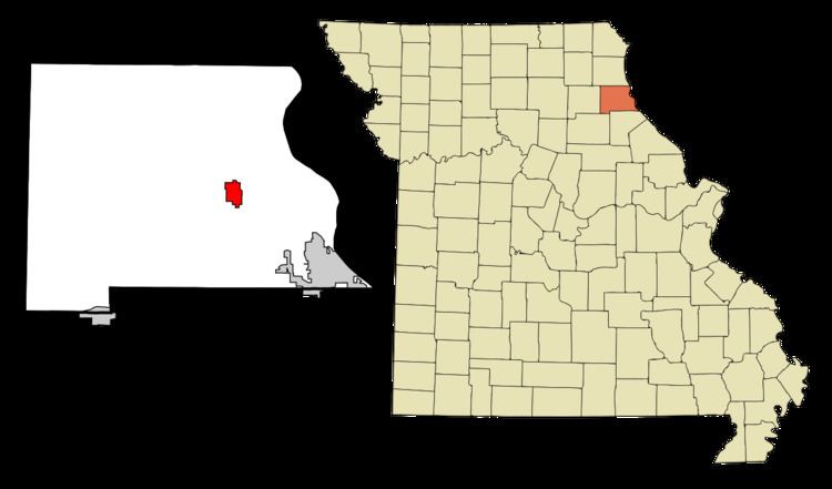
Map of Palmyra, MO 63461, USA
History
Palmyra was platted in 1819, and named after Palmyra, in Syria. The settlement was designated county seat in 1827. A post office called Palmyra has been in operation since 1830.
In 1862, the city was the scene of the Palmyra Massacre, in which ten Confederate prisoners were killed in retaliation for the disappearance of a local Union man.
The Culbertson-Head Farmstead, Dryden-Louthan House, Gardner House, Marion County Jail and Jailor's House, Peter J. Sowers House, Speigle House, Walker-Woodward-Schaffer House, and Ephraim J. Wilson Farm Complex are listed on the National Register of Historic Places.
Geography
Palmyra is located at 39°47′51″N 91°31′29″W (39.797396, -91.524857). According to the United States Census Bureau, the city has a total area of 2.76 square miles (7.15 km2), all of it land.
Transportation
On US 61-24, a divided highway, Palmyra is six miles from I-72 (US 36). St. Louis is about two hours away by car; Springfield, Illinois is a little less. Daily Amtrak trains link nearby Quincy to downtown Chicago. Commuter air service connects Quincy to St. Louis.
Education
Palmyra’s school district serves a 200-square-mile area with 6,700 people; there are 1,150 students and 170 teachers and staff. There are strong early childhood programs, a private parochial school and several day-care facilities. Nearby Hannibal, Canton, Moberly, and Quincy are home to Hannibal-LaGrange College, Culver-Stockton College, Moberly Area Community College, Quincy University, and John Wood Community College.
2010 census
As of the census of 2010, there were 3,595 people, 1,425 households, and 963 families residing in the city. The population density was 1,302.5 inhabitants per square mile (502.9/km2). There were 1,557 housing units at an average density of 564.1 per square mile (217.8/km2). The racial makeup of the city was 95.1% White, 2.6% African American, 0.1% Native American, 0.3% Asian, 0.1% Pacific Islander, 0.4% from other races, and 1.4% from two or more races. Hispanic or Latino of any race were 1.2% of the population.
There were 1,425 households of which 34.9% had children under the age of 18 living with them, 49.5% were married couples living together, 13.7% had a female householder with no husband present, 4.4% had a male householder with no wife present, and 32.4% were non-families. 29.3% of all households were made up of individuals and 14.8% had someone living alone who was 65 years of age or older. The average household size was 2.38 and the average family size was 2.91.
The median age in the city was 37.7 years. 25.4% of residents were under the age of 18; 6.9% were between the ages of 18 and 24; 26.7% were from 25 to 44; 22.8% were from 45 to 64; and 18.4% were 65 years of age or older. The gender makeup of the city was 47.5% male and 52.5% female.
2000 census
As of the census of 2000, there were 3,467 people, 1,372 households, and 923 families residing in the city. The population density was 1,559.9 people per square mile (603.0/km²). There were 1,522 housing units at an average density of 684.8 per square mile (264.7/km²). The racial makeup of the city was 96.22% White, 2.62% African American, 0.23% Native American, 0.26% Asian, 0.03% from other races, and 0.63% from two or more races. Hispanic or Latino of any race were 0.61% of the population.
There were 1,372 households out of which 33.6% had children under the age of 18 living with them, 52.5% were married couples living together, 11.4% had a female householder with no husband present, and 32.7% were non-families. 30.0% of all households were made up of individuals and 16.1% had someone living alone who is 65 years of age or older. The average household size was 2.38 and the average family size was 2.94.
In the city, the population was spread out with 24.8% under the age of 18, 8.9% from 18 to 24, 25.6% from 25 to 44, 20.7% from 45 to 64, and 20.0% who were 65 years of age or older. The median age was 38 years. For every 100 females, there were 88.2 males. For every 100 females age 18 and over, there were 84.3 males.
The median income for a household in the city was $31,284, and the median income for a family was $42,946. Males had a median income of $30,829 versus $19,631 for females. The per capita income for the city was $15,625. About 5.5% of families and 8.1% of the population were below the poverty line, including 7.3% of those under the age of 18 and 10.5% of those 65 and older.