
Country United States County Randolph Incorporated 1868 Local time Tuesday 11:06 PM | State Missouri Founded 1866 Elevation 866 ft (264 m) Zip code 65270 | |
 | ||
Weather -6°C, Wind N at 11 km/h, 55% Humidity Colleges and Universities Moberly Area Communi, Central Christian College o, Moberly Area Technical | ||
Bigrigtravels live st louis to moberly missouri interstate 70 november 15 2016
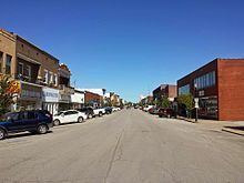
Moberly is a city in Randolph County, Missouri, United States. The population was 13,974 at the 2010 census.
Contents
- Bigrigtravels live st louis to moberly missouri interstate 70 november 15 2016
- Map of Moberly MO USA
- Mfa oil moves jobs to moberly missouri
- History
- Government
- City Council
- Geography
- Demographics
- 2010 census
- 2000 census
- Recreation
- Education
- Transportation
- Media
- Notable people
- References
Map of Moberly, MO, USA
Mfa oil moves jobs to moberly missouri
History
Moberly was founded in 1866, and named after Colonel William E. Moberly, the first president of the Chariton and Randolph County railroads.
Like other towns in the Little Dixie region of Missouri in which it is located, Moberly has a history of racial violence. On February 18, 1893, John Hughes, an African American, was lynched by whites because he was deemed to have insulted a white person. In November 1919, meanwhile, four African-American men alleged to have beaten and robbed a white farmer were arrested. A mob of white men built a fire in Forest Park -- today's Rothwell Park -- and removed the arrested men from the jail. When they attempted to hang George Adams, one of the African-American men, from a tree, the limb broke and when Adams tried to escape the mob shot him dead. The Kansas City Star called the event "a disgrace to the community and the state."
The Missouri state Moberly Correctional Center was constructed two miles south of Moberly in 1963 as a minimum-security prison. As of 2014 it houses about 1800 minimum and medium security inmates.
On Independence Day, 1995, a tornado ripped through downtown Moberly. There were no reported deaths, but there was a large amount of structural damage. Another tornado tore through the area (Renick) on Sunday, March 12, 2006. Four people were killed and thirteen were injured in the F3-level tornado. Dozens of homes were destroyed.
The World War II-era US Navy frigate USS Moberly (PF-63) was named for the town. The ship participated mostly in convoy escort, earning a battle star for her assistance in sinking a German submarine U-853.
Moberly is mentioned in the Tom Waits song "Black Market Baby," from the 1999 album Mule Variations.
The Burkholder-O'Keefe House, Moberly Commercial Historic District, and Moberly Junior High School are listed on the National Register of Historic Places.
Government
The city of Moberly was born of a railroad auction on September 27, 1866. The county incorporated the town in 1868 with a board of trustees. The same year that the Wabash Railroad shops were finished in Moberly, the city entered a charter into state record and incorporated. At the time, there was no such thing as a council-manager government, but the 1950s saw the government form come into vogue in Missouri. Now, the city of Moberly has a council-manager government. The council consists of five members elected for three-year terms and one city counselor who drafts ordinances and acts as legal counsel. Each year, the council elects one of its members as mayor and one as mayor pro tempore to serve for one year. To manage the city and oversee day-to-day operations, the council selects a city manager. In 2015, the government had these officers:
City Council
Geography
Moberly is located at 39°25′13″N 92°26′20″W (39.420398, -92.438831). According to the United States Census Bureau, the city has a total area of 12.26 square miles (31.75 km2), of which, 12.22 square miles (31.65 km2) is land and 0.04 square miles (0.10 km2) is water.
Demographics
The Moberly Micropolitan Statistical Area consists of Randolph County.
2010 census
As of the census of 2010, there were 13,974 people, 4,960 households, and 3,019 families residing in the city. The population density was 1,143.5 inhabitants per square mile (441.5/km2). There were 5,687 housing units at an average density of 465.4 per square mile (179.7/km2). The racial makeup of the city was 86.4% White, 9.7% African American, 0.4% Native American, 0.6% Asian, 0.3% from other races, and 2.6% from two or more races. Hispanic or Latino of any race were 2.1% of the population.
There were 4,960 households of which 32.5% had children under the age of 18 living with them, 40.1% were married couples living together, 15.9% had a female householder with no husband present, 4.8% had a male householder with no wife present, and 39.1% were non-families. 33.4% of all households were made up of individuals and 14.1% had someone living alone who was 65 years of age or older. The average household size was 2.35 and the average family size was 2.97.
The median age in the city was 35.7 years. 22% of residents were under the age of 18; 10.9% were between the ages of 18 and 24; 29.7% were from 25 to 44; 23.5% were from 45 to 64; and 13.9% were 65 years of age or older. The gender makeup of the city was 53.8% male and 46.2% female.
2000 census
As of the census of 2000,there were 11,945 people, 5,001 households, and 3,090 families residing in the city. The population density was 1,033.8 people per square mile (399.3/km²). There were 5,812 housing units at an average density of 503.0 per square mile (194.3/km²). The racial makeup of the city was 90.51% White, 6.71% African American, 0.37% Native American, 0.64% Asian, 0.03% Pacific Islander, 0.39% from other races, and 1.34% from two or more races. Hispanic or Latino of any race were 1.67% of the population.
There were 5,001 households out of which 29.3% had children under the age of 18 living with them, 44.2% were married couples living together, 13.6% had a female householder with no husband present, and 38.2% were non-families. 33.2% of all households were made up of individuals and 16.1% had someone living alone who was 65 years of age or older. The average household size was 2.30 and the average family size was 2.89.
In the city, the population was spread out with 24.8% under the age of 18, 11.1% from 18 to 24, 25.4% from 25 to 44, 20.1% from 45 to 64, and 18.7% who were 65 years of age or older. The median age was 36 years. For every 100 females there were 86.6 males. For every 100 females age 18 and over, there were 80.8 males.
The median income for a household in the city was $28,519, and the median income for a family was $37,488. Males had a median income of $27,152 versus $19,508 for females. The per capita income for the city was $15,478. About 11.1% of families and 15.0% of the population were below the poverty line, including 20.5% of those under age 18 and 14.7% of those age 65 or over.
Recreation
Education
Moberly is home to two colleges; Central Christian College of the Bible and Moberly Area Community College. The Moberly School District consists of four schools, North and South Park Elementary serve grades K-2, grades 3-5 are enrolled in Gratz Brown Elementary, grades 6-8 in Moberly Middle School, and Moberly High School serves grades 9-12 [1]. The Seventh-day Adventist church operates Maranatha Adventist School, a K-8 school. [2] The St. Pius X Catholic Elementary School is operated by the Catholic Church of the same name serves grade K-8. [3]
Transportation
Moberly is served by The Omar Bradley Airport. Commercial service is available 33 miles to the south in Columbia at the Columbia Regional Airport or the MO-X (an airport shuttle to and from STL and MCI), 60 miles to the south in Jefferson City via the Amtrak station, 45 miles to the north in La Plata via the Amtrak station, or 55 miles to the North in Kirksville at the Kirksville Regional Airport.
The city is served by U.S. Route 63 to the east on a bypass. The old route is designated as both Business 63 and Morley Street and goes through town. U.S. Route 24 goes through town as well. Route M (formerly Route 3) also skirts the edge of town. Other routes include Route DD (indirectly goes to Sugar Creek Lake), EE, A, and AA (past the prison). At one time there was a Business 24 that ran from Morley Street via West Coates Street to Johnson Street to Concannon Street turning North on Holman St to current U.S. 24. This route was de-numbered in the late 1960s. State Route 22 was also multiplexed with U.S. 63 to U.S. 24. When U.S. 63 was re-routed in the mid-1960s Highway 22 was truncated to its current end at U.S. 63 near Sturgeon, MO.
The Norfolk Southern Railway serves Moberly running west toward Kansas City, Missouri and east toward Hannibal, Missouri and points on. Norfolk Southern also runs south between Moberly and St. Louis, Missouri (via Centralia and Mexico, MO) and points on. Moberly was once the northern terminus of the Missouri-Kansas-Texas Railroad that ran between Moberly and Boonville, Missouri. Much of this route is still somewhat visible in satellite images.
Moberly is home to one of Norfolk Southern's many rail yards. Norfolk Southern used to have a line that ran north from Moberly to Albia, Iowa, but it was abandoned in the spring of 1992. The line was reopened from 1993-1995 to help in recovery efforts after the great Flood of 1993. By 1997, the line was dismantled between Moberly and Moulton, Iowa.
The Centerville, Iowa-owned Appanoose County Community Railroad currently operates the section from Moulton to Albia, Iowa.
Media
Moberly is served by a daily newspaper, the Moberly Monitor-Index. The Kwix Kres Kirk radio station operates from downtown.