
Country United States County Monterey FIPS code 06-55044 Elevation 7.9 m Zip code 95076 Area code 831 | State California GNIS feature IDs 1659773 Area 240 ha Population 3,070 (1 Apr 2010) | |
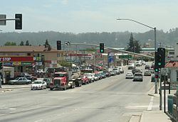 | ||
Pajaro is a census-designated place (CDP) in Monterey County, California, United States. Pajaro is located on the south bank of the Pajaro River 5 miles (8 km) northeast of its mouth, at an elevation of 26 feet (8 m). The population was 3,070 at the 2010 census, down from 3,384 at the 2000 census. The school district is in Santa Cruz County.
Contents
Map of Pajaro, CA 95076, USA
The town, the name of which is derived from pájaro (bird in Spanish), is in the Pajaro Valley on the Pajaro River, which divides the city from Watsonville and Santa Cruz County.
Geography
Pajaro is located at 36°54′15″N 121°44′55″W.
According to the United States Census Bureau, the CDP has a total area of 0.9 square miles (2.3 km2), all of it land.
History
The Pajaro post office operated from 1872 to 1873 and from 1882 to 1888.
This town was heavily flooded in 1995 and 1998.
The oldest building in the community of Pajaro is the Porter-Vallejo Mansion. Constructed in the 1840s and remodeled multiple times, it was acquired in 1991 by then-Monterey County Supervisor Marc Del Piero and converted into a public library/senior citizen center. Additionally, it also houses a day-care facility for the children of migrant farm workers.
On Monday, May 11, 1903, President Theodore Roosevelt stopped in Pajaro for a ten-minute whistle stop address on his way to Santa Cruz. He arrived in his special train via the Southern Pacific at 8:50am and left at 9:00am.
2010
The 2010 United States Census reported that Pajaro had a population of 3,070. The population density was 3,312.2 people per square mile (1,278.8/km²). The racial makeup of Pajaro was 1,451 (47.3%) White, 15 (0.5%) African American, 78 (2.5%) Native American, 53 (1.7%) Asian, 0 (0.0%) Pacific Islander, 1,281 (41.7%) from other races, and 192 (6.3%) from two or more races. Hispanic or Latino of any race were 2,889 persons (94.1%).
The Census reported that 2,979 people (97.0% of the population) lived in households, 91 (3.0%) lived in non-institutionalized group quarters, and 0 (0%) were institutionalized.
There were 621 households, out of which 444 (71.5%) had children under the age of 18 living in them, 409 (65.9%) were opposite-sex married couples living together, 86 (13.8%) had a female householder with no husband present, 57 (9.2%) had a male householder with no wife present. There were 41 (6.6%) unmarried opposite-sex partnerships, and 3 (0.5%) same-sex married couples or partnerships. 46 households (7.4%) were made up of individuals and 19 (3.1%) had someone living alone who was 65 years of age or older. The average household size was 4.80. There were 552 families (88.9% of all households); the average family size was 4.82.
The population was spread out with 1,067 people (34.8%) under the age of 18, 432 people (14.1%) aged 18 to 24, 970 people (31.6%) aged 25 to 44, 471 people (15.3%) aged 45 to 64, and 130 people (4.2%) who were 65 years of age or older. The median age was 25.6 years. For every 100 females there were 124.1 males. For every 100 females age 18 and over, there were 134.3 males.
There were 655 housing units at an average density of 706.7 per square mile (272.8/km²), of which 141 (22.7%) were owner-occupied, and 480 (77.3%) were occupied by renters. The homeowner vacancy rate was 1.4%; the rental vacancy rate was 3.2%. 620 people (20.2% of the population) lived in owner-occupied housing units and 2,359 people (76.8%) lived in rental housing units.
2000
As of the census of 2000, there were 3,384 people, 634 households, and 571 families residing in the CDP. The population density was 3,614.1 people per square mile (1,390.0/km²). There were 667 housing units at an average density of 712.4 per square mile (274.0/km²). The racial makeup of the CDP was 42.94% White, 0.47% African American, 1.65% Native American, 1.51% Asian, 0.35% Pacific Islander, 48.29% from other races, and 4.79% from two or more races. Hispanic or Latino of any race were 94.24% of the population.
There were 634 households out of which 66.9% had children under the age of 18 living with them, 67.5% were married couples living together, 14.5% had a female householder with no husband present, and 9.9% were non-families. 6.3% of all households were made up of individuals and 3.0% had someone living alone who was 65 years of age or older. The average household size was 5.28 and the average family size was 5.25.
In the CDP, the population was spread out with 39.6% under the age of 18, 15.5% from 18 to 24, 30.3% from 25 to 44, 10.4% from 45 to 64, and 4.2% who were 65 years of age or older. The median age was 23 years. For every 100 females there were 119.5 males. For every 100 females age 18 and over, there were 124.2 males.
The median income for a household in the CDP was $38,315, and the median income for a family was $37,083. Males had a median income of $17,384 versus $17,917 for females. The per capita income for the CDP was $9,893. About 20.4% of families and 22.2% of the population were below the poverty line, including 23.8% of those under age 18 and 5.0% of those age 65 or over.
Some public services in the Community of Pajaro are provided by the Pajaro-Sunny Mesa Community Services District (PSMCSD) which was organized, according to the Watsonville Register-Pajaronian newspaper, by then- Monterey County Supervisor Marc Del Piero and the Monterey County Board of Supervisors in 1984. PSMCSD, a non-profit, governmental agency, provides public water services, public sewer services, park services, and street lighting services to the community. PSMCSD has also significantly expanded its service areas to provide water services to the Prunedale, Elkhorn, and Moss Landing communities of North Monterey County.