
Region Central Coast County seat Santa Cruz Area 1,572 km² Population 269,419 (2013) | Incorporated February 18, 1850 Largest city Santa Cruz Founded 1850 Area code Area code 831 | |
 | ||
Country United States of America CSA San Jose-San Francisco-Oakland Rivers Pajaro River, Pescadero Creek, Gazos Creek Destinations Santa Cruz, Big Basin Redwoods State Park, Monterey Bay, Capitola, Felton Points of interest Santa Cruz Beach Boardwalk, Natural Bridges State Bea, Mystery Spot, Wilder Ranch State Park, Henry Cowell Redwood | ||
Santa Cruz County, California, officially the County of Santa Cruz, is a county on the Pacific coast of the U.S. state of California. As of the 2010 census, the population was 262,382. The county seat is Santa Cruz.
Contents
- Map of Santa Cruz County CA USA
- History
- Geography
- Flora and fauna
- 2010
- 2000
- Politics
- Crime
- Top employers
- Winemaking and wineries
- Four year universities
- Two year college
- Major highways
- County routes
- Public transportation
- Airports
- Cities
- Unincorporated community
- Population ranking
- References
Map of Santa Cruz County, CA, USA
Santa Cruz County comprises the Santa Cruz-Watsonville, CA Metropolitan Statistical Area, which is also included in the San Jose-San Francisco-Oakland, CA Combined Statistical Area. The county is on the California Central Coast, south of the San Francisco Bay Area region. The county forms the northern coast of the Monterey Bay, with Monterey County forming the southern coast.
History
Santa Cruz County was one of the original counties of California, created in 1850 at the time of statehood. In the original act, the county was given the name of "Branciforte" after the Spanish pueblo founded there in 1797. A major watercourse in the county, Branciforte Creek, still bears this name. Less than two months later on April 5, 1850, the name was changed to "Santa Cruz" ("Holy Cross").
Mission Santa Cruz, established in 1791 and completed in 1794, was destroyed by the 1857 Fort Tejon earthquake, but a smaller-scale replica was erected in 1931.
Geography
According to the U.S. Census Bureau, the county has a total area of 607 square miles (1,570 km2), of which 445 square miles (1,150 km2) is land and 162 square miles (420 km2) (27%) is water. It is the second-smallest county in California by land area and third-smallest by total area. Of California's counties, only San Francisco is physically smaller.
The county is situated on a wide coastline with over 29 miles (47 km) of beaches. It is a strip of about 10 miles (16 km) wide between the coast and the crest of the Santa Cruz Mountains at the northern end of the Monterey Bay. It can be divided roughly into four regions: the rugged "north coast"; the urban City of Santa Cruz, Soquel, Capitola, and Aptos; mountainous Bonny Doon, San Lorenzo River Valley; and the fertile "south county", including Watsonville and Corralitos. Agriculture is concentrated in the coastal lowlands of the county's northern and southern ends. Most of the coastline is flanked by cliffs.
Flora and fauna
Santa Cruz County is home to the following threatened or endangered species:
Año Nuevo State Marine Conservation Area, Greyhound Rock State Marine Conservation Area and Natural Bridges State Marine Reserve are marine protected areas off the coast of Santa Cruz County. Like underwater parks, these marine protected areas help conserve ocean wildlife and marine ecosystems.
2010
The 2010 United States Census reported Santa Cruz County had a population of 262,382. The racial makeup of Santa Cruz County was 190,208 (72.5%) White, 2,766 (1.1%) African American, 2,253 (0.9%) Native American, 11,112 (4.2%) Asian, 349 (0.1%) Pacific Islander, 43,376 (16.5%) from other races, and 12,318 (4.7%) from two or more races. Hispanic or Latino of any race were 84,092 persons (32.0%).
2000
As of the census of 2000, there were 255,602 people, 91,139 households, and 57,144 families residing in the county. The population density was 574 people per square mile (222/km2). There were 98,873 housing units at an average density of 222 per square mile (86/km2).
There were 91,139 households out of which 31.9% had children under the age of 18 living with them, 48.0% were married couples living together, 10.2% had a female householder with no husband present, and 37.3% were non-families. 25.1% of all households were made up of individuals and 8.2% had someone living alone who was 65 years of age or older. The average household size was 2.71 and the average family size was 3.25.
In the county, the population was spread out with 23.8% under the age of 18, 11.9% from 18 to 24, 30.8% from 25 to 44, 23.5% from 45 to 64, and 10.0% who were 65 years of age or older. The median age was 35 years. For every 100 females there were 99.7 males. For every 100 females age 18 and over, there were 97.8 males.
The median income for a household in the county was $53,998, and the median income for a family was $61,941. Males had a median income of $46,291 versus $33,514 for females. The per capita income for the county was $26,396. About 6.7% of families and 11.9% of the population were below the poverty line, including 12.50% of those under age 18 and 6.30% of those age 65 or over.
Santa Cruz county residents tend to be well-educated. 38.3% of residents age 25 and older hold a bachelor's degree at least, significantly higher than the national average of 27.2% and the state average of 29.5%.
Politics
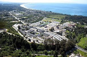
Santa Cruz County was a Republican stronghold for most of the 19th and 20th centuries; from 1860 to 1972 the only Democrats to carry Santa Cruz were Woodrow Wilson in 1916, Franklin D. Roosevelt in 1932 and 1936 and Lyndon B. Johnson in 1964. However, the opening of UCSC in 1965 caused the county’s political landscape to dramatically change.
Today, it is a strongly Democratic county in presidential and congressional elections. The last Republican to carry the county was Ronald Reagan in 1980, and the last Republican to win a majority in the county was Richard Nixon in 1968. The last Republican to represent a significant portion of Santa Cruz in Congress was Burt L. Talcott, who was defeated in 1976 by Leon Panetta.
Santa Cruz County is split between California's 18th and 20th congressional districts, represented by Anna Eshoo (D–Atherton) and Jimmy Panetta (D–Carmel Valley), respectively.
In the State Assembly, Santa Cruz County is split between the 29th and 30th Assembly districts, represented by Democrat Mark Stone and Democrat Anna Caballero, respectively. In the State Senate, Santa Cruz County is entirely in the 17th Senate District, represented by Democrat Bill Monning.
In 2008, 71.4% of voters in Santa Cruz County voted against Proposition 8, which amended the California Constitution to ban legal recognition of same-gender marriages.
Crime
The following table includes the number of incidents reported and the rate per 1,000 persons for each type of offense.
Top employers
According to the County's 2010 Comprehensive Annual Financial Report, the top employers in the county are:
Winemaking and wineries
Winemaking—both the growing of the grapes and their vinting—is an important part of the economic and cultural life of Santa Cruz County. The wines of the David Bruce Winery and Ridge Vineyards were selected for tasting in the Paris Wine Tasting of 1976 (Tabor, p.167-169).
Four-year universities
Two-year college
Major highways
[California State Route 678 State Route 678
County routes
Public transportation
Santa Cruz County is served by the Santa Cruz Metropolitan Transit District bus system.
An Amtrak Thruway Motorcoach "Highway 17 Express" bus between Santa Cruz and San Jose is jointly operated by Amtrak, the SCMTD and the Santa Clara Valley Transportation Authority. Greyhound Lines bus service also serves Santa Cruz County.
Airports
Watsonville Municipal Airport is a public general aviation airport. There are two air carriers based at the airport offering on-demand air charter:
There is a notable private airport, Monterey Bay Academy Airport, which is a former military base.
The nearest airports for scheduled commercial travel include San Jose International Airport, Monterey Regional Airport, San Francisco International Airport, and Oakland International Airport.
Cities
Unincorporated community
Population ranking
The population ranking of the following table is based on the 2010 census of Santa Cruz County.
† county seat