
Vehicle registration JH Elevation 418 m | Time zone IST (UTC+5:30) Lok Sabha constituency Hazaribagh | |
 | ||
Padma is a community development block that forms an administrative division in Barhi subdivision of Hazaribagh district in the Indian state of Jharkhand.
Contents
Map of Padma, Jharkhand 825411
Geography
Padma is located at 24.2000°N 85.3667°E / 24.2000; 85.3667.
The block is situated at 23 kilometres (14 mi) north of Hazaribagh. Hazaribagh National Park is 5 kilometres (3.1 mi) from Padma. The Gram Panchayats covered by Padma intermediate panchayat are: Bandarbela, Bihari, Kutipisi, Padma, Pindarkon, Romi, Saraiya, and Suryapura.
History
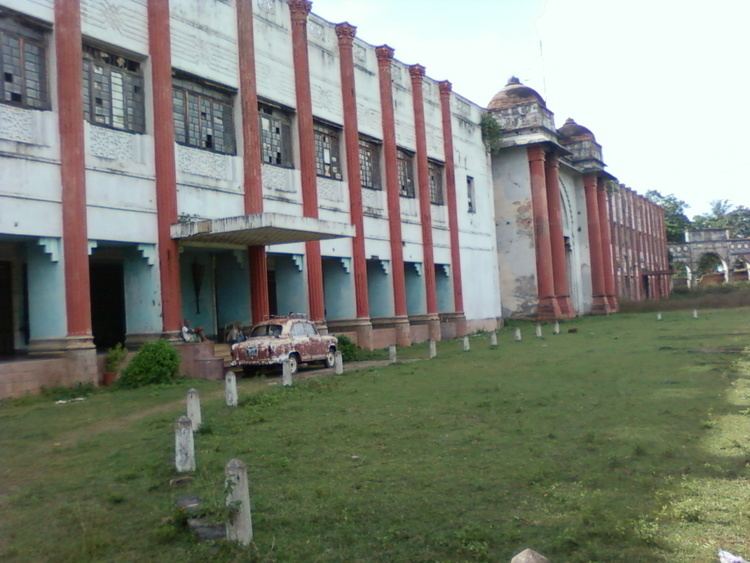
Padma was the seat of Ramgarh Raj and the palace is located there.
Padma Block was established on 27 September, 1995.
Demographics
As per 2011 Census of India, Padma CD Block had a total population of 56,014, all of which were rural. There were 28,941 males and 27,073 females. Scheduled Castes numbered 9,928 and Scheduled Tribes numbered 843.
Literacy
As of 2011 census, the total number of literates in Padma CD Block was 32,133 out of which 19,195 were males and 12,938 were females.
Transport
Padma is on NH-33.
The 79.7 km long first stage railway project from Koderma to Hazaribagh costing ₹ 936 crore was inaugurated by Prime Minister Narendra Modi on 20 February 2015. The railway line passes through the Padma CD Block and there is a station at Padma.