
- elevation 758 m (2,487 ft) - elevation 477 m (1,565 ft) | ||
 | ||
- location Castle Hill in Tidbinbilla Nature Reserve | ||
Paddys River, a perennial stream that is part of the Murrumbidgee catchment within the Murray-Darling basin, is located in the Australian Capital Territory, Australia.
Contents
Map of Paddys River, ACT, Australia
Location and features
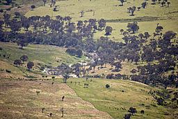
Paddys River rises on the eastern slopes of the Brindabella Ranges in the south-west of the Australian Capital Territory (ACT), below Castle Hill in Tidbinbilla Nature Reserve, within Namadgi National Park and is formed by the confluence of Blue Gum Creek and Punchbowl Creek. The river, joined by Tidbinbilla River and Gibraltar Creek, flows generally north-west and to the west of the Canberra suburbs of Conder and Gordon, before reaching its confluence with Cotter River, near Mount Stromlo. The river descends 281 metres (922 ft) over its 28-kilometre (17 mi) course.
References
Paddys River (Australian Capital Territory) Wikipedia(Text) CC BY-SA