
Basin area 16,291 km² Bridges Chakri Railway bridge | Length 513 km | |
 | ||
River mouth Chao Phraya River at Ayutthaya Island Basin size 16,291 km (6,290 sq mi) Discharge Average rate:2.4 km (0.58 cu mi)/yr | ||
The Pa Sak River (Thai: แม่น้ำป่าสัก, rtgs: Maenam Pa Sak, [mɛ̂ːnáːm pàː sàk], Pronunciation) is a river in central Thailand. The river originates in the Phetchabun Mountains, Dan Sai District, Loei Province, and passes through Phetchabun Province as the backbone of the province. It then passes through the eastern part of Lopburi Province and Saraburi Province, until it joins together with the Lopburi River northeast of Ayutthaya Island, before it runs into the Chao Phraya River southeast of Ayutthaya near Phet Fortress. It has a length of 513 km (319 mi) and drains a watershed of 16,291 km2 (6,290 sq mi). The annual discharge is 2.4 km3 (0.58 cu mi).
Contents
- Map of Pa Sak Phra Nakhon Si Ayutthaya Thailand
- Kayaking at pa sak river
- Tributaries
- Pa Sak basin
- References
Map of Pa Sak, Phra Nakhon Si Ayutthaya, Thailand
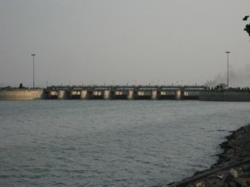
The valley of the Pa Sak through the Phetchabun mountains is the main part of Phetchabun Province. As the watershed of the river is rather narrow, the amount of water in the river varies seasonally. To address drought problems in the lower Pa Sak valley, in 1994 the construction of the Pa Sak Cholasit Dam (เขื่อนป่าสักชลสิทธิ์) in Lopburi Province was built. The 4,860-meter (15,940 ft) wide and 36.5-meter (120 ft) high dam keeps a total of 0.785 km3 (0.188 cu mi) of water. The dam also supplies about 6.7 MW of hydro-electric power.
Kayaking at pa sak river
Tributaries
Tributaries of the Pa Sak include the Lopburi, Muak Lek, Phung, Pa Daeng, Kong, Sonthi, Wang Chomphu, Na, Chun, Duk, Khon Kaen, Yai, Saduang Yai, Ban Bong, Tarang, and Phaya Klang Rivers.
Pa Sak basin
The Pa Sak drains a total land area of 16,291 square kilometres (6,290 sq mi). The Pa Sak Basin is part of the Chao Phraya Watershed.