Rahul Sharma (Editor)

Pa Hin Ngam National Park

Updated on
Edit
Like
Comment
Share on FacebookTweet on TwitterShare on LinkedInShare on Reddit
Area
  
112 km²

Established
  
1986

Phone
  
+66 44 890 015

Pa Hin Ngam National Park

Location
  
Thep Sathit district, Chaiyaphum Province, Thailand

Address
  
หมู่ 9 Tambon Ban Rai, Amphoe Thep Sathit, Chang Wat Chaiyaphum 36230, Thailand

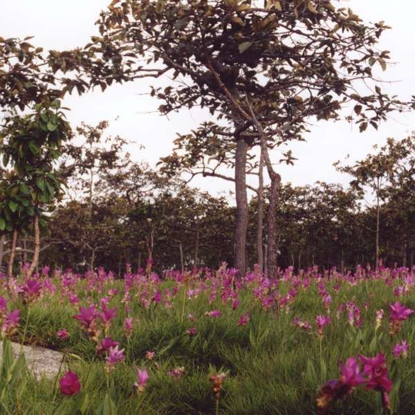
Pa Hin Ngam (Thai: ป่าหินงาม) is a national park in Chaiyaphum Province, Thailand. "Hin ngam" means "beautiful stone", "pa" means "forest". The park got its name from the strange rock formations at the west end of the park. Erosion has carved several large rocks into striking and unusual shapes.

In 1985, the Tep Satit Forestry Department first surveyed the area, long popular with locals, and recommended its protection. In October 1986, Pa Hin Ngam Park was created, covering 10 km2 around the strange rock formations which gave the park its name. In 1993, the Forestry Department of Thailand conducted a more thorough survey including the surrounding area, and recommended that it become a national park. The national park covering 112 km2 was created on 19 September 1994, which was officially gazetted in 2007.

The park is at the boundary of the Dong Phaya Yen Mountains and the Khorat Plateau. The steep cliff at the 846 m high Sut Phan Din viewpoint affords a view into a valley of the Sonthi River and the Sap Langka Wildlife Sanctuary. The name "Sut Phan Din" (สุดแผ่นดิน) means "end of land", reflecting the steepness of the cliff. This cliff also marks the watershed between the Chao Phraya and the Mekong rivers.

  • Lan Hin Ngam (ลานหินงาม) It was caused by the erosion of the soil and rocks into different shapes, which can be imagined as many kinds of objects and animals such as nails, radar, and hens.
  • Dok Kra Jiao or Bua Sawan Field (ทุ่งดอกกระเจียว หรือ ทุ่งบัวสวรรค์) Kra Jiao, a kind of curcuma, is an annual plant in the same species as ginger-galingale, scattered generally from Lan Hin Ngam to the Sut Phaendin viewpoint. Near the viewpoint is one of the fields of the Siam tulip (Curcuma alismatifolia), called "Dok Kra Jiao" (ดอกกระเจียว) in Thai. The dipterocarp forests bloom with the purple flowers at the beginning of the rainy season in July.
  • Sut Phaendin (สุดแผ่นดิน) is a steep cliff and the highest point of the Phang Hoei mountain range, two kilometres from the park office at 846 metres elevation. It is the cliff connecting between the central and northeastern regions.
  • Namtok Thep Phana (น้ำตกเทพพนา) is a medium-size waterfall originating from Huai Krachon flowing from the Phang Hoei mountain range. It has three tiers. There is water only during the rainy season.
  • Pa hin ngam national park thep satid post amphur thep sathit chaiyaphum thailand 1


    References

    Pa Hin Ngam National Park Wikipedia