
Area code 03682 Elevation 645 m Population 965 (1 Apr 2009) | Time zone CET (UTC+1) Vehicle registration LI Local time Monday 4:28 AM Postal code 8951 | |
 | ||
Weather 6°C, Wind W at 3 km/h, 85% Humidity | ||
Pürgg-Trautenfels is a former municipality in the district of Liezen in Styria, Austria. Since the 2015 Styria municipal structural reform, it is part of the municipality Stainach-Pürgg.
Contents
Map of P%C3%BCrgg-Trautenfels, Austria
Geography
Pürgg-Trautenfels lies in valley of the upper Ennstal between Gröbming and Stainach. The municipal area is bordered in the south by the Enns; in the north it stretches right up to the main ridge Toten Gebirges (Almkogel, 2,116m elevation). The highest point of the municipality is the Grimming (2,351 m) in the west.
Pürgg
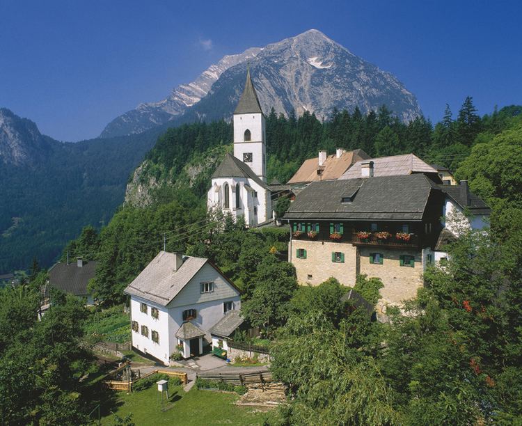
The village of Pürgg lies on a small plateau in the south face of the Rantensteins, about 150 m above the valley floor of the brook Grimmingbach. The village has a few narrow streets which are largely for pedestrian traffic only. The houses are nestled around two churches.
Trautenfels
The village of Trautenfels is a small settlement around the Schloss Trautenfels, situated directly on the Enns. The castle is on a small hill which towers about 30 meters above the valley floor. In 1261 it was called a castle (Burg) for the first time. In the baroque era it was given its present appearance by Friedrich von Trauttmannsdorf.
Few meters to the west of the castle, on the same ridge, there lie the ruins of the Protestant church Neuhaus. This was, at the time of the Reformation, the most significant religious center in the Upper Ennstal Valley. The church was established by the castle owners in Trautenfels. But soon she fell victim to the Counter-Reformation. In 1991 the remnants of the building were exposed and furnished as a memorial.
Economy
Trautenfels Castle and the picturesque village of Pürgg attract numerous tourists and day trippers. The region is also popular with climbers, who set out from here on mountain tours to the Grimming, into the Totes Gebirge and the Niedere Tauern to the south. In the Wörschachwald is a small ski resort and the Spechtensee lake, a popular tourist destination.