
Elevation 10 m (30 ft) Area code 026, 0481, 0488 Local time Tuesday 5:58 PM | Established 1 January 2001 Time zone CET (UTC+1) Area 115.1 km² | |
 | ||
Postcode 6660–6662, 6665–6668, 6670–6678 Weather 21°C, Wind SW at 18 km/h, 35% Humidity Points of interest Park Lingezegen, Tempels van Elst, Gelderse Smalspoor Stichting, Museumboerderij Den Tip, Drielse Stuwdam | ||
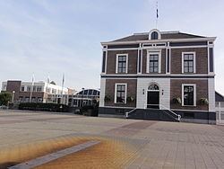
Overbetuwe ( pronunciation ) is a municipality in the province of Gelderland in the Netherlands. It was formed on 1 January 2001 as a merger of three former municipalities: Elst, Heteren and Valburg. Overbetuwe is bordered in the north by the river Rhine and in the south by the river Waal. The city hall is located in Elst, the largest town in the municipality. Together with eighteen other municipalities it forms the 'Knooppunt Arnhem-Nijmegen' (English: 'Arnhem-Nijmegen conurbation'), or simply 'KAN', which is a regional collaboration.
Contents
Map of Overbetuwe, Netherlands
Transportation
Because of its central location between the cities of Nijmegen and Arnhem, many inhabitants of Overbetuwe commute between these cities. Three major highways are situated in the municipality; the A50, A15 and A325. Overbetuwe has two railway stations: Elst and Zetten-Andelst. Besides these two existing railway lines, a controversial freight line called the Betuweroute has been operational from 2007.
Politics
The distribution of council seats after the 2010 elections is shown here.