Area of Search CambridgeshireNorfolk Interest Biological Area 25.14 km² | Grid reference TL 490 879 Location map Magic Map Notification 1984 | |
 | ||
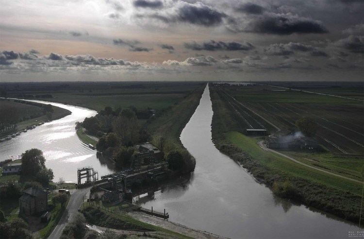
A january afternoon at rspb ouse washes
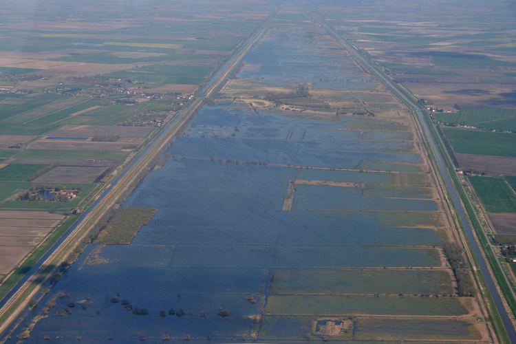
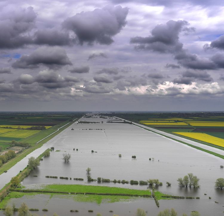
Ouse Washes is a linear 2,513.6 hectare biological Site of Special Scientific Interest stretching from near St Ives in Cambridgeshire to Downham Market in Norfolk. It is also a Ramsar internationally important wetland site, a Special Protection Area under the European Union Birds Directive, a Special Area of Conservation, and a Nature Conservation Review site, Grade I. An area of 186 hectares between March and Ely is managed by the Wildlife Trust for Bedfordshire, Cambridgeshire and Northamptonshire, and another area near Chatteris is managed by the Royal Society for the Protection of Birds. The Wildfowl & Wetlands Trust manages another area near Welney.
Contents
- A january afternoon at rspb ouse washes
- Duck shooting wildfowling ouse washes 2013
- Ecology
- History
- RSPB Ouse Washes
- WWT Welney Wetland Centre
- Ouse Washes Landscape Partnership
- References
Duck shooting wildfowling ouse washes 2013
Ecology
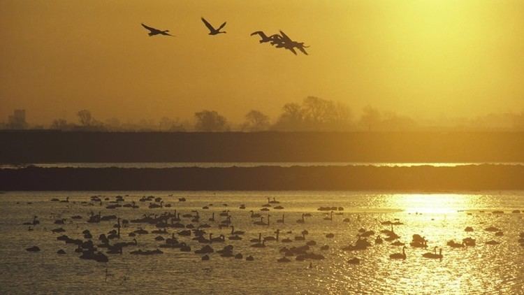
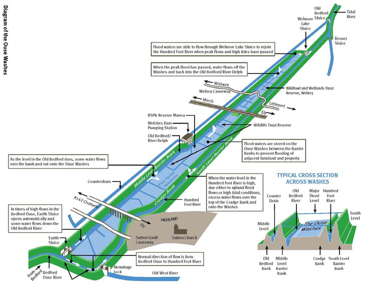
The site lies between the Old Bedford River in the north-west and the New Bedford River in the south-east. The Washes are a flood storage area and are often under water in the winter. It is internationally significant for wintering and breeding wildfowl and waders, especially teal, pintails, wigeons, shovelers, pochards and Bewick's swans. The site also has rich aquatic fauna and flora, and areas of unimproved grassland.
History

In 1630, King Charles I granted a drainage charter to the 4th Earl of Bedford who engaged the Dutch engineer Cornelius Vermuyden to construct the two Bedford rivers. The purpose of the new rivers was to facilitate drainage of the Great Ouse between Earith and Downham Market. The area between the rivers is 20 miles (32 km) long and almost a mile wide and acts as washland, i.e. a floodplain during the winter and, increasingly, also in summer. When they are flooded this causes a 30-mile (48 km) detour for local residents.
RSPB Ouse Washes
RSPB Ouse Washes is a nature reserve, managed by the Royal Society for the Protection of Birds at Welches Dam. It is signposted from Manea village which is 6 miles (9.7 km) east of Chatteris on the A142/A141 between Ely and March. The visitor centre is open 9am to 5pm daily except Christmas Day and Boxing Day.
WWT Welney Wetland Centre
WWT Welney Wetland Centre is one of nine wildfowl and wetland reserves managed by the Wildfowl & Wetlands Trust. The reserve is at Welney in Norfolk, 12 miles (19 km) north of Ely, 26 miles (42 km) north of Cambridge and 33 miles (53 km) east of Peterborough. The eco-friendly visitor centre features exhibits about the natural history and culture of The Fens and its inhabitants, an art gallery, gift shop and café. Activities include nature programs, pond dipping, trails and hides.
Ouse Washes Landscape Partnership
The Ouse Washes Landscape Partnership scheme (OWLP) is a 3-year project supported by the Heritage Lottery Fund which runs from 2014 - 2017. The scheme focuses on the promotion of the area surrounding the Ouse Washes, the heart of the Cambridgeshire and Norfolk Fens, and on encouraging community engagement with the area’s diverse heritage.