
River mouth Chiers180 m (590 ft) Length 67 km | Basin size 256 km (99 sq mi) Basin area 256 km² | |
 | ||
Main source Gondrecourt-Aix252 m (827 ft) Discharge Average rate:2.91 m/s (103 cu ft/s) | ||
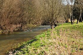
The Othain is a 67-kilometre (42 mi) long river in the Meurthe-et-Moselle and Meuse départements, northeastern France. Its source is at Gondrecourt-Aix, in the Woëvre. It flows generally northwest. It is a left tributary of the Chiers into which it flows between Villécloye and Montmédy.
Contents
Map of L'Othain, France
Communes along its course
This list is ordered from source to mouth:
References
Othain Wikipedia(Text) CC BY-SA