
Subprefectures BrieyLunévilleToul Department number 54 Area 5,246 km² | Time zone CET (UTC+1) Arrondissements 4 Population 731,004 (2013) | |
 | ||
Points of interest Place Stanislas, Musée de l'École de Nancy, Museum of Fine Arts of Nancy, Parque de la Pépinière, Jardin botanique du Montet Colleges and Universities University of Lorraine, ICN Graduate Business, Nancy 2 University, École nationale supérieur, School of architecture of Nancy | ||
Nancy et sa place stanislas meurthe et moselle france
Meurthe-et-Moselle ([mœʁte mɔzɛl]) is a department in the Grand Est region of France, named after the Meurthe and Moselle rivers.
Contents
- Nancy et sa place stanislas meurthe et moselle france
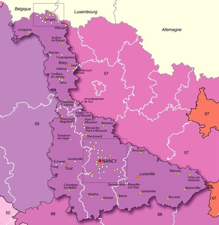
- Map of Meurthe et Moselle France
- History
- Geography
- Economy
- Demographics
- References
Map of Meurthe-et-Moselle, France
History
Meurthe-et-Moselle was created in 1871 at the end of the Franco-Prussian War from the parts of the former departments of Moselle and Meurthe which remained French territory.
The current boundary between Meurthe-et-Moselle and Moselle was the border between France and Germany from 1871 to 1919 and again between 1940 and 1944. The only subsequent change took place in 1997 and involved the incorporation, for administrative reasons, of the little commune of Han-devant-Pierrepont which had previously fallen within the Meuse department.
Geography
Meurthe-et-Moselle is part of the administrative region of Grand Est and the traditional region of Lorraine and is surrounded by the departments of Meuse, Vosges, Bas-Rhin, and Moselle; and by the nations of Luxembourg and Belgium. Parts of Meurthe-et-Moselle belong to the Lorraine Regional Natural Park.
The department extends for 130 km from north to south and is between 7 and 103 km wide.
Its chief rivers are:
Economy
The economy was highly dependent on mining until the 1960s. There are iron, salt, and lime extraction sites. The urban area around Nancy has a very dynamic economy based largely on services, research, and higher education.
Demographics
The inhabitants of the department are known as Meurthe-et-Mosellans. The area around Nancy has become highly urbanized, whereas the Saintois in the south is quite rural.