
District Braunau am Inn Vehicle registration BR Elevation 423 m Local time Monday 6:38 PM Postal code 5121 | Time zone CET (UTC+1) Website www.ostermiething.at Area 21.71 km² Population 3,136 (1 Apr 2009) Area code 06278 | |
 | ||
Weather 14°C, Wind NE at 16 km/h, 29% Humidity | ||
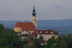
Ostermiething is a municipality in the district of Braunau am Inn in the Austrian state of Upper Austria.
Contents
Map of Ostermiething, Austria
Geography
Ostermiething lies in the upper Innviertel on the western edge of the Weilhart forest directly across the Salzach from Germany. There is a bridge to the Bavarian town of Tittmoning.
References
Ostermiething Wikipedia(Text) CC BY-SA