
Country United States FIPS code 29-55388 Elevation 229 m Population 923 (2013) Number of airports 1 | Time zone Central (CST) (UTC-6) GNIS feature ID 0756486 Zip code 64776 Local time Monday 6:03 AM | |
 | ||
Weather 11°C, Wind E at 8 km/h, 100% Humidity Area 243 ha (236 ha Land / 8 ha Water) | ||
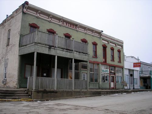
Lot 4 sheldon addition osceola missouri
Osceola is a city in St. Clair County, Missouri, United States. The population was 947 at the 2010 census. It is the county seat of St. Clair County.
Contents
- Lot 4 sheldon addition osceola missouri
- Map of Osceola MO 64776 USA
- History
- Geography
- 2010 census
- 2000 census
- Notable residents
- Fictional residents
- References
Map of Osceola, MO 64776, USA
History
Located on the Osage River, the land that became the town of Osceola was inhabited by the tribe of Native Americans who gave the river its name. Two treaties, in 1808 and 1825, signed by the Osage and the U.S. government gave up all the tribe's land in Missouri. With the way cleared for non-native settlers, more people began to arrive in the St. Clair County area in the mid-1830s. The first home was built in the future Osceola in the winter of 1835. Osceola was laid out in 1841. It was named for Osceola, chief of the Seminole tribe.
The town was the site of the September 1861 Sacking of Osceola by Jayhawkers in which the town was burned and its courthouse looted. The event inspired the 1976 Clint Eastwood film The Outlaw Josey Wales. Prior to the attack the town had a population of around 2,500. However, fewer than 200 residents remained after the event and the population has never again approached those numbers. In September 2011, lingering bad feelings over the raid and the sesquicentennial of the event prompted the Osceola Board of Aldermen to pass a resolution asking the University of Kansas no longer to use "Jayhawk" as their mascot and nickname. Further, the resolution asks Missouri residents to stop spelling Kansas or KU with a capital letter because "neither is a proper name or a proper place".
The Osceola Public School Building was added to the National Register of Historic Places in 1999.
Geography
Osceola is located at 38°2′47″N 93°41′58″W (38.046427, -93.699512). According to the United States Census Bureau, the city has a total area of 0.94 square miles (2.43 km2), of which, 0.91 square miles (2.36 km2) is land and 0.03 square miles (0.08 km2) is water.
2010 census
As of the census of 2010, there were 947 people, 394 households, and 225 families residing in the city. The population density was 1,040.7 inhabitants per square mile (401.8/km2). There were 502 housing units at an average density of 551.6 per square mile (213.0/km2). The racial makeup of the city was 94.2% White, 1.7% African American, 0.7% Native American, 0.1% Asian, 0.4% from other races, and 2.9% from two or more races. Hispanic or Latino of any race were 3.1% of the population.
There were 394 households of which 31.0% had children under the age of 18 living with them, 35.8% were married couples living together, 16.0% had a female householder with no husband present, 5.3% had a male householder with no wife present, and 42.9% were non-families. 39.6% of all households were made up of individuals and 22.1% had someone living alone who was 65 years of age or older. The average household size was 2.14 and the average family size was 2.81.
The median age in the city was 39.7 years. 21.9% of residents were under the age of 18; 8.2% were between the ages of 18 and 24; 27% were from 25 to 44; 22.8% were from 45 to 64; and 20.2% were 65 years of age or older. The gender makeup of the city was 50.2% male and 49.8% female.
2000 census
As of the census of 2000, there were 835 people, 373 households, and 207 families residing in the city. The population density was 896.1 people per square mile (346.7/km²). There were 472 housing units at an average density of 506.5 per square mile (196.0/km²). The racial makeup of the city was 97.37% White, 0.36% African American, 0.60% Native American, 0.24% Asian, 0.12% Pacific Islander, 0.48% from other races, and 0.84% from two or more races. Hispanic or Latino of any race were 1.08% of the population.
There were 373 households out of which 26.8% had children under the age of 18 living with them, 40.2% were married couples living together, 12.9% had a female householder with no husband present, and 44.5% were non-families. 39.1% of all households were made up of individuals and 22.8% had someone living alone who was 65 years of age or older. The average household size was 2.13 and the average family size was 2.86.
In the city, the population was spread out with 24.6% under the age of 18, 7.1% from 18 to 24, 26.9% from 25 to 44, 20.7% from 45 to 64, and 20.7% who were 65 years of age or older. The median age was 38 years. For every 100 females there were 95.1 males. For every 100 females age 18 and over, there were 84.8 males.
The median income for a household in the city was $21,563, and the median income for a family was $27,250. Males had a median income of $26,786 versus $15,750 for females. The per capita income for the city was $17,247. About 13.5% of families and 19.1% of the population were below the poverty line, including 18.2% of those under age 18 and 12.9% of those age 65 or over.