
Elevation 860 ft (262 m) Population 4,372 (2013) | Incorporated 1959 Zip code 65065 Local time Monday 3:44 AM | |
 | ||
Founded 1886 (as Zebra)1935 (as Osage Beach) Weather 11°C, Wind NE at 5 km/h, 92% Humidity Points of interest Miner Mike's Inc, Get Air Osage Beach, Pogue Hollow Cove, Rhino Truck Bed Liners Osage Beach | ||
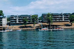
Osage Beach is a city in Camden and Miller counties in the U.S. state of Missouri. Most of the city is in Camden County, while a small eastern sliver is in Miller County. The population was 4,351 at the 2010 census.
Contents
- Map of Osage Beach MO USA
- History
- Geography
- 2010 census
- 2000 census
- Schools
- Colleges and universities
- Media
- Health Care
- References
Map of Osage Beach, MO, USA
History
The city, known today as Osage Beach, was originally named Zebra, Missouri. The city's post office was established in 1886 and was located on the riverbottom, which was east of the present day post office. The Grand Glaize bridge was replaced in the 1980s. Like the surrounding areas, Zebra was nothing more than a name with a post office. Zebra was soon flooded out during the construction of the Bagnell Dam, which created one of the North America's largest man-made lakes — the Lake of the Ozarks. The post office was rebuilt on the top of a nearby cliff at the heart of the brand new lake. In 1935, residents of the city changed the post office designation to Osage Beach, but no official boundaries were formulated until the early 1960s.
Osage Beach was officially incorporated on May 22, 1959. However, due to political upheaval and discontent among some in the new town, a petition for disincorporation was filed. On May 17, 1960, voters approved legal disincorporation in a special election. But the battle wasn't over yet. In late 1963, a group interested in re-incorporation began organizing and planning a strategy for change. The group lobbied for incorporation stating that with a growing community certain services could only be afforded to the people through local government organization; for instance, sanitation, fire and police protection, street development, sewer and water service, and even the right to serve liquor-by-the-drink through city liquor licensing. Tourists were becoming more common to the area as entertainment and lake activities grew in popularity, many residents were moving in permanently, new businesses were forming, and the group feared without incorporation Osage Beach did not progress and ultimately would lose its identity as the Lake's largest and most progressive recreational area. The group met publicly to discuss the advantages and disadvantages of incorporation and directly confronted the issues that dealt with the disincorporation of 1960. The public was eventually called to another special election in 1965.
In the spring of 1965, voters approved the second and final incorporation of the City of Osage Beach and a fourth class city was created or more appropriately stated — re-created. Official boundaries of the city were established, four wards were formed (two on each side of the Grand Glaize bridge) and two aldermen per ward, a mayor, and a marshall were to be elected at large.
Geography
Osage Beach is located at 38°8′18″N 92°38′55″W (38.138354, -92.648678).
According to the United States Census Bureau, the city has a total area of 10.33 square miles (26.75 km2), of which, 9.75 square miles (25.25 km2) is land and 0.58 square miles (1.50 km2) is water. The city is located on the shores of the Lake of the Ozarks.
2010 census
As of the census of 2010, there were 4,351 people, 2,038 households, and 1,166 families residing in the city. The population density was 446.3 inhabitants per square mile (172.3/km2). There were 5,261 housing units at an average density of 539.6 per square mile (208.3/km2). The racial makeup of the city was 93.6% White, 1.1% African American, 0.6% Native American, 1.1% Asian, 0.2% Pacific Islander, 2.4% from other races, and 1.1% from two or more races. Hispanic or Latino of any race were 4.8% of the population.
There were 2,038 households of which 19.9% had children under the age of 18 living with them, 44.3% were married couples living together, 8.0% had a female householder with no husband present, 5.0% had a male householder with no wife present, and 42.8% were non-families. 35.3% of all households were made up of individuals and 13% had someone living alone who was 65 years of age or older. The average household size was 2.04 and the average family size was 2.57.
The median age in the city was 48.9 years. 15.8% of residents were under the age of 18; 8.6% were between the ages of 18 and 24; 20.2% were from 25 to 44; 31.3% were from 45 to 64; and 24% were 65 years of age or older. The gender makeup of the city was 48.9% male and 51.1% female.
2000 census
As of the census of 2000, there were 3,662 people, 1,687 households, and 1,035 families residing in the city. The population density was 389.8 people per square mile (150.4/km²). There were 4,055 housing units at an average density of 431.6 per square mile (166.6/km²). The racial makeup of the city was 97.35% White, 0.76% African American, 0.41% Native American, 0.49% Asian, 0.16% from other races, and 0.82% from two or more races. Hispanic or Latino of any race were 1.20% of the total population.
There were 1,687 households out of which 19.1% had children under the age of 18 living with them, 51.2% were married couples living together, 7.2% had a female householder with no husband present, and 38.6% were non-families. 31.6% of all households were made up of individuals and 10.9% had someone living alone who was 65 years of age or older. The average household size was 2.09 and the average family size was 2.58.
In the city, the population was spread out with 16.0% under the age of 18, 7.4% from 18 to 24, 26.9% from 25 to 44, 29.3% from 45 to 64, and 20.3% who were 65 years of age or older. The median age was 45 years. For every 100 females there were 96.8 males. For every 100 females age 18 and over, there were 94.9 males.
The median income for a household in the city was $38,448, and the median income for a family was $49,554. Males had a median income of $30,444 versus $21,440 for females. The per capita income for the city was $22,685. About 4.5% of families and 6.7% of the population were below the poverty line, including 5.3% of those under age 18 and 6.4% of those age 65 or over.
Schools
Colleges and universities
Media
Osage Beach is split between two television markets. While Camden County is part of the Springfield television market, Miller County is part of the Columbia/Jefferson City market. Charter Communications' cable system carries stations from both cities. DirecTV and Dish Network subscribers in the city receive Springfield stations, mainly because the bulk of the city is in Camden County.
Health Care
Osage Beach is home to Lake Regional Hospital. Part of the Lake Regional Health system, this general medical and surgical hospital houses a trauma center and has a total of 116 beds.