 | ||
Province Province of Santa Cruz de Tenerife Similar | ||
Tenerife day 4 orotava valley
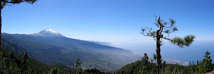
The Orotava Valley (Spanish: Valle de la Orotava) is an area in the northern part of the island of Tenerife, Canary Islands, Spain. The valley measures 10 km by 11 km, and stretches from the north coast to about 2,000 m elevation, at the northern foot of Pico del Teide. To the west and east, the valley is delimited by two steep escarpments, respectively the Ladera de Tigaiga and the Ladera de Santa Ursula. The valley takes its name from La Orotava, the largest town in the area. Other towns are Los Realejos and Puerto de la Cruz. In the era of the Guanches, before the conquest by the Spanish in 1496, the valley was known as Taoro.
Contents
- Tenerife day 4 orotava valley
- Map of Valle de La Orotava 38300 Santa Cruz de Tenerife Spain
- Orotava valley excursion canary islands cruise cunard
- References
Map of Valle de La Orotava, 38300, Santa Cruz de Tenerife, Spain
Orotava valley excursion canary islands cruise cunard
References
Orotava Valley Wikipedia(Text) CC BY-SA
