
District Ústí nad Orlicí Elevation 426 m | Postal code 561 11 to 562 01 Area 13.52 km² | |
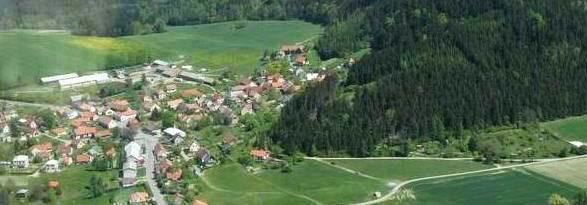 | ||
Orlické Podhůří is a village and municipality (obec) in the Ústí nad Orlicí District, Pardubice Region of the Czech Republic.
Map of 562 01 Orlick%C3%A9 Podh%C5%AF%C5%99%C3%AD, Czechia
The municipality covers an area of 13.52 square kilometres (5.22 sq mi), and has a population of 606 (as at 3 July 2006).
Orlické Podhůří lies approximately 6 kilometres (4 mi) north-west of Ústí nad Orlicí, 40 km (25 mi) east of Pardubice, and 138 km (86 mi) east of Prague.
References
Orlické Podhůří Wikipedia(Text) CC BY-SA