
Capital | Area 503,239 km2 | |
 | ||
Country Democratic Republic of the Congo Languages spoken Swahili, Lingala | ||
Map of Orientale Province
Orientale (French: Province orientale) (also Oriental; formerly Haut-Zaïre, then Haut-Congo) is one of the eleven former provinces of the Democratic Republic of the Congo. The province laid in the northeast of the country. It bordered Équateur to the west, Kasaï-Oriental province to the southwest, Maniema to the south, and North Kivu to the southeast. It also bordered the Central African Republic and South Sudan to the north, and Uganda to the east. The provincial capital is Kisangani.
Contents
The province was divided into the Bas-Uele, Haut-Uele and Tshopo districts and the Ituri Interim Administration. These became provinces in 2015 under the 2006 constitution.
Msf fights malaria in orientale province drc
History
Orientale Province was formed in 1966 from the amalgamation of the regions of Uele, Kibali-Ituri and Haut-Congo. In 2015, the province dissolved into the provinces of Bas-Uele, Haut-Uele, Ituri and Tshopo.
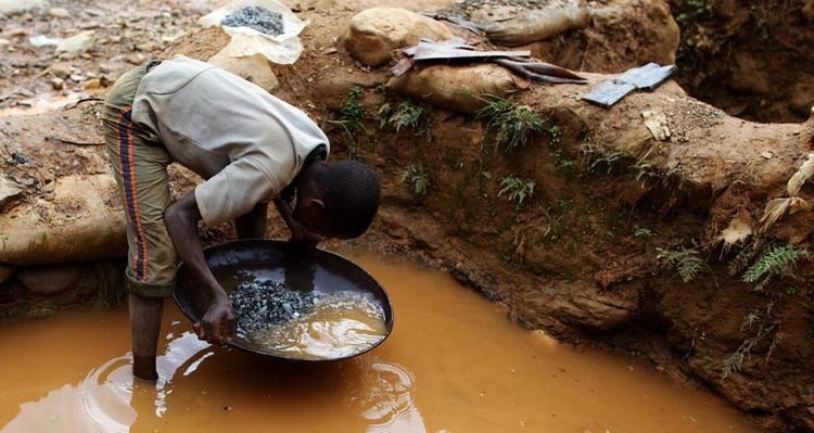
In 1998 the Orientale villages of Durba and Watsa were the center of an outbreak of Marburg virus disease among gold mine workers.
The Ituri district of Orientale was the scene of the Ituri conflict.
As of 2014, militia groups continue to fight in the province and have reportedly committed many atrocities against the local population, such as forcing women into sex slavery and forcing men to work in mines.