Time zone CET (UTC+1) Website www.oostgelre.nl Local time Saturday 9:59 AM Area code 0544 | Elevation 21 m (69 ft) Postcode 7130–7141, 7263 Area 83.34 km² Team Longa '30 | |
 | ||
Weather 10°C, Wind NE at 14 km/h, 56% Humidity | ||
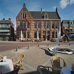
Oost Gelre is a municipality in the Achterhoek, in the eastern Netherlands. On 1 January 2005, the municipalities Groenlo and Lichtenvoorde merged and formed the new municipality Oost Gelre, which was called Groenlo until 19 May 2006.
Contents
Map of Oost Gelre, Netherlands
Population centres
Dutch Topographic map of the municipality of Oost Gelre, June 2015
References
Oost Gelre Wikipedia(Text) CC BY-SA
