
Length 51.3 km | Constructed 29 March 1962 | |
 | ||
Existed: March 29, 1962 – present Northwest end: Highway 17B in Echo Bay Major cities Sault Ste. Marie, Bruce Mines, Macdonald, Meredith and Aberdeen Additional | ||
Secondary Highway 638, commonly referred to as Highway 638, is a secondary highway located in the District of Algoma in the Canadian province of Ontario. The route begins at Highway 17B in Echo Bay and travels eastward to Ophir, where it turns south to Bruce Mines, ending at Highway 17. The north–south portion of the route was designated in 1956 as Highway 561. In 1962, Highway 638 was designated from Echo Bay to Highway 561, as well as a segment of the latter route from Ophir to Dunns Valley. The highway took on its current routing in 1989, assuming the route of Highway 561 south from Ophir to Bruce Mines; the section of Highway 638 from Ophir to Dunns Valley was renumbered as Highway 670.
Contents
Route description
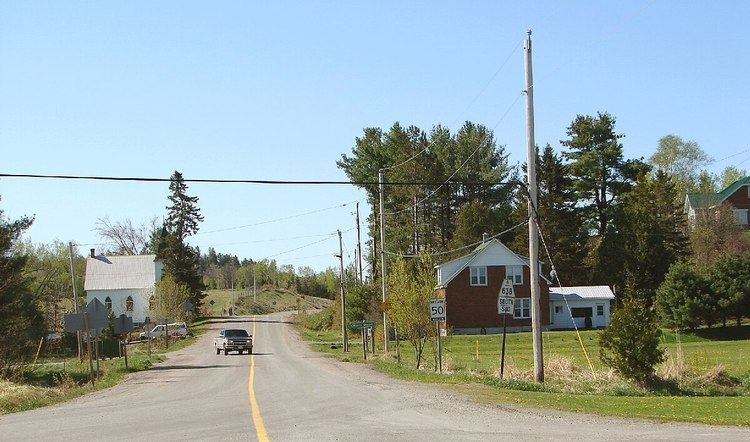
Highway 638 is 51.3 kilometres (31.9 mi) in length, extending from Highway 17B in Echo Bay eastward through the communities of Sylvan Valley, Leeburn and Ophir, where it turns southward and runs south through Rydal Bank, Bruce Station, and finally to its southeastern terminus, also at Highway 17, in the town of Bruce Mines.
History
The first section of today's Highway 638 was designated as Highway 561. The route, assigned in 1956 alongside many of the secondary highways in the province, travelled north from Bruce Mines to Ophir, where it turned east to Dunns Valley then north to Skookum Lake. On March 29, 1962, Highway 638 was assumed, travelling from Echo Bay to Highway 561. In addition, the portion of Highway 561 between Ophir and Dunns Valley was renumbered as part of the new route; the section north of the Wanamaker Creek bridge in Dunns Valley was decommissioned. This routing remained consistent until mid- to late 1989, when Highway 561 was renumbered as part of Highway 638. The route between Ophir and Dunns Valley was renumbered Highway 670 at the same time.
Highway 17B
From 2007 to 2009, the highway extended for an additional 15.6 kilometres westerly from Echo Bay, to another junction with Highway 17 in Sault Ste. Marie. The extended route from Echo Bay to Sault Ste. Marie was formerly an alignment of Highway 17, the route of the Trans-Canada Highway through the region, and was redesignated as part of Highway 638 when Highway 17 was rerouted along a four-lane expressway alignment which opened on October 31, 2007.
However, the Garden River First Nation, citing a 1909 agreement with the province whereby ownership of the highway reverts to the band after realignment, refused to accept the highway being badged as anything other than Highway 17B. The provincial Ministry of Transportation, has decommissioned most B-suffixed highways in Ontario, but the band posted unofficial "Highway 17B" signs at the eastern and western limits of the reserve.
The municipal councils of Sault Ste. Marie and Macdonald, Meredith and Aberdeen Additional, which border Garden River on either side and are also located on the route of the disputed roadway, both passed municipal resolutions in 2007 supporting Garden River's position and calling on the province to designate the road as Highway 17B.
As of February 2009, the segment is officially designated as 17B, and the route of Highway 638 once again ends at its original pre-2007 terminus in Echo Bay. However, exit signs along the Highway 17 bypass route do not identify the road with a 17B shield, but only as Bar River Road.
Future
The safety of the current at-grade intersection at Highway 17 has been called into question by local residents. In February 2011, the Ministry of Transportation announced that this crossing will be upgraded to a full interchange.
Major intersections
The following table lists the major junctions along Highway 638, as noted by the Ministry of Transportation of Ontario. The entire route is located in Algoma District.