
Country Namibia Capital | Area 84,981 km2 Governor | |
 | ||
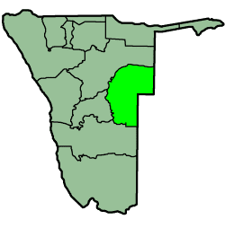
Map of Omaheke Region
Omaheke is one of the fourteen regions of Namibia, its capital is Gobabis. It lies on the eastern border of Namibia and is the Western extension of the Kalahari desert. The name Omaheke is the Herero word for Sandveld.
Contents
- Map of Omaheke Region
- Namibia promo omaheke region
- Characteristics
- History
- Politics
- 2004
- 2015
- Economy and infrastructure
- Demographics
- Language
- Borders
- References
Namibia promo omaheke region
Characteristics
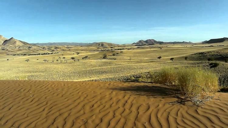
A large part of this region is known as the Sandveld. The northeastern part of the region is still very much wilderness.
Anthropologically, almost the entire Ovambanderu and Gobabis-Ju/wa ethnic groups reside in the region. Furthermore, it is a rich cultural area for Herero, Damara-Nama, Tswana, Afrikaner and German, with a sprinkling of northerners.
A notable event is the annual Meat Festival.
History
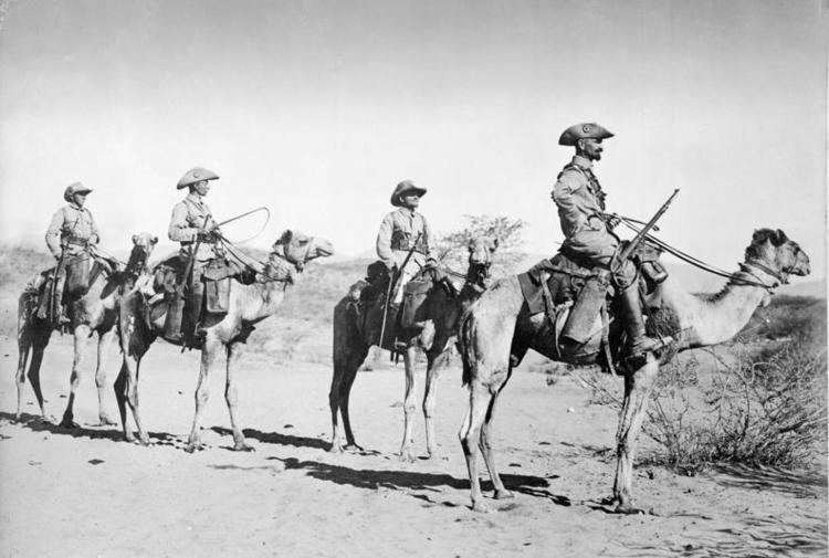
On 11 August 1904, a German armed force with artillery and machine guns, which had encircled the Herero who had fled to the Waterberg in Namibia, attacked and forced the survivors to flee to the Omaheke desert, where large numbers died. Those who tried to emerge from the desert were killed by German patrols along the perimeter of the Omaheke. This was the turning point in the Herero and Namaqua Genocide.
Politics
Laura McLeod-Katjirua of SWAPO was Governor of Omaheke Region from 2001 to 2012, when she was transferred to the same position at Khomas Region. Festus Ueitele was appointed as her successor in April 2013.
The region comprises seven constituencies Upon independence of Namibia, Hereroland East was absorbed into the region.:
2004
In the 2004 presidential election, the Omaheke Region supported SWAPO's Hifikepunye Pohamba with 13,005 votes (46%) but the Ohangwena Region native did not win a majority of the votes in the region. National Unity Democratic Organisation (NUDO)'s Kuaima Riruako, paramount chief of the Herero people, received over 7,000 votes (25%), and the DTA's Katuutire Kaura received over 3,700 votes (13%). Only in the much more populated Khomas Region and neighboring Otjozondjupa Region did Riruako gain more votes and in no other region did NUDO's candidate gain a higher percentage of the votes.
2015
In the 2015 regional elections Swapo won four of the seven constituencies. Aminuis and Otjinene went to NUDO, and Otjombinde was won by an independent candidate.
Economy and infrastructure
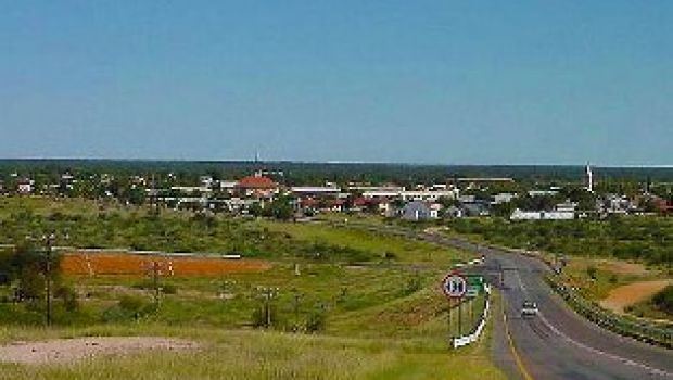
Gobabis is the main centre of this area and also its main business area, as it is linked with the capital of Namibia, Windhoek, by rail and the tarred B6 national road. This infrastructure serves as the main supply line for the region.
All the other population centres in the region are linked with Gobabis by road. Many other services are rendered from Gobabis to the region, such as the Police Divisional Headquarters, which is situated in Gobabis. Clinics in the region are served by medical practitioners based in Gobabis, and there are two hospitals and a clinic serving the region.
The agricultural patterns of this region is to a large extent homogenous. Most of the 900 commercial and 3,500 communal farmers in this area are cattle breeders. A regional office of the Ministry of Agriculture, serving the whole region, is based in Gobabis.
Hunting, including trophy hunting, is one of the major sources of income for the region. This takes place mainly in the winter months, from June to August. During these months, tourists from the northern hemisphere can be seen in the area, enjoying the mild and dry winter climate and collecting trophies.
Omaheke has 42 schools with a total of 18,365 pupils.
Demographics
According to the 2012 Namibia Labour Force Survey, unemployment in the Omaheke Region is 34.1%.
Language
According to the 2001 census, 39% of the population speak Otjiherero languages, 27% speak Nama/Damara and 12% speak Afrikaans at home.
Borders
In the east, Omaheke borders are three districts of Botswana:
Domestically, it borders the following regions:
Omaheke is traversed by the northwesterly line of equal latitude and longitude.