
Urban settlements 0 | Rural localities 8 Area 72,352 km² | |
 | ||
Municipally incorporated as | ||
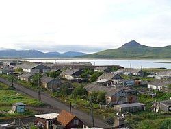
Olyutorsky District (Russian: Олю́торский райо́н) is an administrative and municipal district (raion) of Koryak Okrug of Kamchatka Krai, Russia, one of the eleven in the krai. It is located in the northeast of the krai. The area of the district is 72,352 square kilometers (27,935 sq mi). Its administrative center is the rural locality (a selo) of Tilichiki. Population: 5,036 (2010 Census); 7,170 (2002 Census); 12,833 (1989 Census). The population of Tilichiki accounts for 34.6% of the district's total population.
Contents
Map of Olyutorsky District, Kamchatka Krai, Russia
Geography
The major rivers in the district are the Pakhacha and the Apuka. Their headwaters are close to the north-flowing Mayn River, and the Velikaya River, branches of the Anadyr. Lantzeff speaks also of the Olyutora River, which does not appear on modern maps and which he distinguishes from the Pakhacha.
History
In 1714, Russians built the ostrog (fortress) of Olyutorsk to control the coast and land route from Kamchatka to Anadyrsk; a function it shared with Aklansk. It was besieged by the Yukaghirs and Koryaks. It lost its importance after the sea route from Okhotsk was opened.
Demographics
The Alyutors, a branch of the Koryaks lived in the area or somewhat west. There were also Yukaghirs, some of whom had been brought south by the Russians.