
Area 1,612 km² | ||
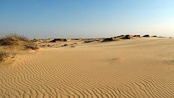 | ||
Oleshky Sands (Ukrainian: Олешківські піски) is the largest expanse of sand in Ukraine. It is situated inland from the Ukrainian coast of the Black Sea and consists of sand dunes or kuchuhury (locally), which reach a height of five meters. Some sparse vegetation can be located across the sands.
Contents
Map of Oleshky Sands, Kherson Oblast, Ukraine
Geography
The Oleshky Desert is located in Oleshky Raion, Kherson Oblast, 30 km (~20 mi) east of Kherson. Before the Russian annexation of the Crimean Khanate at the end of the 18th century, the territory belonged to the nomad Nogai Hordes, particularly the Djambuilut Horde. No detailed historical information about the region has survived.
The closest populated settlement is seven kilometers away (~4.5 mi). In Soviet times the sands were used as an Air Force bombing range for pilots of the Warsaw Pact alliance. To this day there is a possibility of finding some unexploded ordnance.
Environment
Due to its temperature and the amount of precipitation these sands sometimes are qualified as a semi-desert. Oleshky Sands are 15 km in diameter (~10 mi) and they are surrounded by a very dense forest planted to prevent dunes moving. Due to its density, the forest often catches fire. Although a relatively small sandy steppe, the Oleshky Sands have sandstorms. They occur due to the type of the sand in the area as it is very fine and is easily picked up by a wind. The intensity of the sandstorms is rather weak. In the Oleshky sands at the depth of 300–400 m (~1000 ft) there is an underground lake, which forms an essential part of the local environment.