
Population 224 (2011) Sovereign state United Kingdom | OS grid reference SK959334 | |
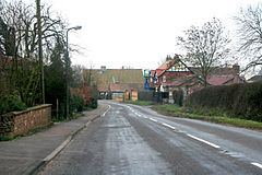 | ||
Old Somerby is a village and civil parish in the South Kesteven district of Lincolnshire, England. It lies 3 miles (5 km) south-east from Grantham, on the B1176 road, approximately 1 mile (1.6 km) east from its junction with the A52 and B6403, and 0.2 miles (250 m) from the East Coast Main Line. The population of the civil parish at the 2011 census was 224.
Contents
Map of Old Somerby, Grantham, UK
Adjacent villages are Ropsley and Boothby Pagnell. Despite its small size, the village is divided into Old Somerby, High Somerby and Low Somerby.
The ecclesiastical parish is part of The North Beltisloe Group of parishes, of the Deanery of Beltisloe in the Diocese of Lincoln. From 2006 to 2011 the incumbent was Rev Richard Ireson.
The village public house is the Fox and Hounds on Grantham Road (B1176).
History
Somerby was a colony of the Danes who ruled Lincolnshire after peace was made with King Alfred in 878. The village is listed in the Domesday Book.
The village church in High Somerby is dedicated to St Mary Magdalene, the same dedication as at nearby Bitchfield.
The village belonged to the historical wapentake of Winnibriggs and Threo.
Nearby there is the site of a moated manor house.