
Topo map USGS Grays Peak Elevation 3,549 m | Easiest route Scramble, class 3 Prominence 285 m | |
 | ||
Similar Cobb Peak, Hyndman Peak, Angel's Perch, Goat Mountain, Devils Bedstead East | ||
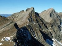
Old Hyndman Peak, at 11,775 feet (3,589 m) above sea level is the eighth-highest peak in the Pioneer Mountains of the U.S. state of Idaho. The peak is located on the border of Sawtooth and Salmon-Challis National Forests as well as Blaine and Custer counties. It is the 27th-highest peak in Idaho and about 0.9 mi (1.4 km) southeast of Hyndman Peak and 0.8 mi (1.3 km) northeast of Cobb Peak.
Map of Old Hyndman Peak, Idaho 83333, USA
References
Old Hyndman Peak Wikipedia(Text) CC BY-SA