
Existed: c. 1961 – present Length 21.44 km | South end: SH-9 north of Ft. Cobb Constructed 1961 | |
 | ||
North end: SH-152 southwest of Binger | ||
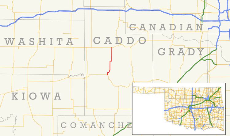
State Highway 146 (abbreviated SH-146) is a short state highway in Caddo County, Oklahoma. It runs for 13.32 miles (21.44 km), connecting State Highway 9 to State Highway 152, at an intersection sometimes known as Three-Way Corner. It provides access to Fort Cobb Lake and Fort Cobb State Park. Along the way it passes through Albert. It has no lettered spur routes.
Contents
Map of OK-146, Fort Cobb, OK 73038, USA
SH-146 was added to the state highway system around 1961. The highway was established with its present-day routing and has always been paved along the entirety of its route.
Route description
State Highway 146 begins at SH-9 north of Fort Cobb. SH-146 heads due north for one mile (1.6 km) before making a sharp turn to the east. After approximately one-half mile (0.80 km), the highway turns north-northwest, crossing over Cobb Creek, the outlet of Fort Cobb Lake. The highway then resumes a due north course, passing about one mile (1.6 km) east of the lake. After around five miles (8.0 km), the highway makes another ninety-degree turn to due east, returning to due north after approximately three-quarters of a mile (1.21 km). Two miles (3.2 km) north of this curve, the highway passes through Albert, an unincorporated location. SH-146 continues north of Albert for five miles (8.0 km) before reaching Three Way Corner, its junction with SH-152, where it ends.
History
SH-146 first appeared on the 1962 official state map. At this time, the highway followed its present-day route, and its entire length was paved. No changes have been made to the route since 1962.
Junction list
The entire route is in Caddo County.