
Country United States Area code 405 Elevation 382 m Local time Tuesday 8:17 PM | Time zone Central (CST) (UTC−6) FIPS code 40-27100 Zip code 73038 | |
 | ||
Weather 11°C, Wind NE at 16 km/h, 48% Humidity University Caddo-Kiowa Technology Center | ||
Fort Cobb is a town in Caddo County, Oklahoma, United States. The population was 634 at the 2010 census.
Contents
Map of Fort Cobb, OK, USA
Geography
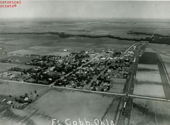
Fort Cobb is located west of the center of Caddo County at 35°5′58″N 98°26′19″W (35.099581, -98.438498), in the valley of the Washita River. Oklahoma State Highway 9 passes through the town, leading east 15 miles (24 km) to Anadarko, the county seat, and west 11 miles (18 km) to Carnegie.
According to the United States Census Bureau, Fort Cobb has a total area of 0.54 square miles (1.4 km2), of which 0.01 square miles (0.02 km2), or 1.57%, is water.
Demographics
As of the census of 2000, there were 667 people, 270 households, and 189 families residing in the town. The population density was 1,307.1 people per square mile (505.0/km²). There were 317 housing units at an average density of 621.2 per square mile (240.0/km²). The racial makeup of the town was 77.96% White, 1.20% African American, 16.04% Native American, 0.45% from other races, and 4.35% from two or more races. Hispanic or Latino of any race were 5.25% of the population.
There were 270 households out of which 35.2% had children under the age of 18 living with them, 55.9% were married couples living together, 11.5% had a female householder with no husband present, and 30.0% were non-families. 28.1% of all households were made up of individuals and 16.7% had someone living alone who was 65 years of age or older. The average household size was 2.47 and the average family size was 3.05.
In the town, the age distribution of the population shows 28.9% under the age of 18, 7.3% from 18 to 24, 26.7% from 25 to 44, 19.8% from 45 to 64, and 17.2% who were 65 years of age or older. The median age was 37 years. For every 100 females there were 86.8 males. For every 100 females age 18 and over, there were 74.3 males.
The median income for a household in the town was $25,625, and the median income for a family was $34,000. Males had a median income of $26,786 versus $18,854 for females. The per capita income for the town was $15,085. About 12.5% of families and 17.6% of the population were below the poverty line, including 20.6% of those under age 18 and 17.8% of those age 65 or over.
History
Fort Cobb was established as a US Army frontier post in Indian Territory on October 1, 1859, 1 mile (1.6 km) east of the present location of the town. The fort was named after Secretary of the Treasury Howell Cobb, a friend of the founding officer, Major William Emory. The post was later occupied by both Southern and Northern forces during the Civil War.
Later, General George Armstrong Custer's command was encamped at Fort Cobb from December 18, 1868, to January 6, 1869. Shortly after that, on March 12, 1869, the fort was abandoned in favor of a location 30 miles (48 km) to the south near the Wichita Mountains, and renamed Fort Sill.