
Existed: 1912 – present Constructed 1912 | Length 71 km | |
 | ||
Counties | ||
Ohio state route 91 top 6 facts
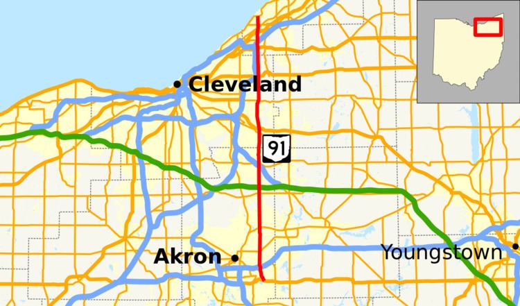
State Route 91 (SR 91), formerly known as Inter-county Highway 91 until 1921 and State Highway 91 in 1922, is a north–south state highway in the northeastern portion of the U.S. state of Ohio. Its southern terminus is at U.S. Route 224 (East Waterloo Road) in Springfield Township, east of Akron. Its northern terminus is at State Route 283 (Lake Shore Boulevard) on the Timberlake/Eastlake border less than one mile (1.6 km) south of Lake Erie.
Contents
Map of OH-91, Ohio, USA
The route is known as "Canton Road" from its southern terminus to just north of its interchange with Interstate 76 (Canton Road continues south as County Route 66, a former portion of State Route 8). North of this interchange, it is called "Darrow Road" until it enters the city of Tallmadge, where it is named "South Avenue" south of the Tallmadge Circle, and "North Avenue" north of the circle. It next passes through the Munroe Falls village limits and is known as "South Main Street" and "North Main Street." It becomes "Darrow Road" once again in the city of Stow and for its remaining length in Summit County, aside from within the Hudson city limits, where it is "South" and "North Main Street."
In Cuyahoga and Lake Counties, State Route 91 is known as "SOM Center Road," named for the fact that it runs through the centers of the original Solon, Orange and Mayfield Townships in Cuyahoga County.
The State Route 91 corridor includes views of some of the best examples of Connecticut Western Reserve town planning, particularly the quaint public squares of Hudson, Tallmadge, and Mayfield. It also dissects several other picturesque and affluent communities of Northeast Ohio, including Gates Mills, Pepper Pike, Hunting Valley, Moreland Hills and Solon (which also has remnants of a Western Reserve public square).