
Existed: 1987 – present Constructed 1987 | Length 10.6 km | |
 | ||
Counties | ||
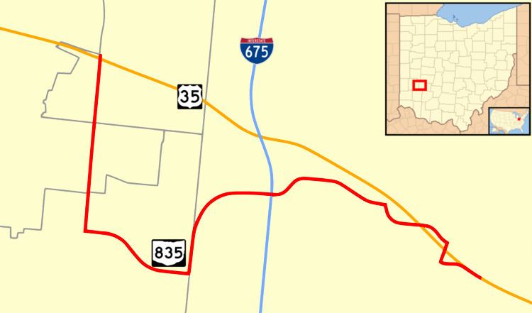
State Route 835 is an east–west state highway in the southwestern portion of the U.S. state of Ohio.
Contents
Map of OH-835, Ohio, USA
Route description
State Route 835 connects to U.S. Route 35 on both ends, starting at that route's interchange with Woodman Drive (C-74) approximately 4½ miles east of Downtown Dayton. From there, the route occupies a portion of Woodman Drive for about 1.5 miles (2.4 km) south to Patterson Road on which the route heads east for about a mile. From there it turns north onto Research Boulevard which gradually turns to the east and follows to the route's terminus at the U.S. Route 35 interchange with North Fairfield Road (C-9) in Beavercreek. State Route 835 does not intersect with any other state highways.
References
Ohio State Route 835 Wikipedia(Text) CC BY-SA