
Area 1,077 km² Population 163,204 (2013) | Website www.co.greene.oh.us Founded 1 May 1803 | |
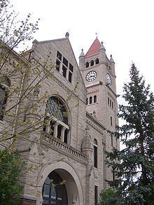 | ||
Colleges and Universities Wright State University, Cedarville University, Central State University, Antioch College, Wilberforce University Points of interest Glen Helen Nature Preserve, John Bryan State Park, Huffman Prairie, Clifton Gorge State Nat, Community Park | ||
War on corruption greene county ohio
Greene County is a county located in the U.S. state of Ohio. As of the 2010 census, the population was 161,573. Its county seat is Xenia. The county was established on March 24, 1803 and named for General Nathanael Greene, an officer in the Revolutionary War.
Contents
- War on corruption greene county ohio
- Map of Greene County OH USA
- Enviroflight doing business in greene county ohio
- Geography
- Adjacent counties
- National protected area
- 2000 census
- 2010 census
- Government
- Higher education
- Public
- Private
- Public schools
- Private schools
- Cities
- Villages
- Census designated places
- Unincorporated communities
- References
Map of Greene County, OH, USA
Greene County is part of the Dayton, OH Metropolitan Statistical Area.
Enviroflight doing business in greene county ohio
Geography
According to the U.S. Census Bureau, the county has a total area of 416 square miles (1,080 km2), of which 414 square miles (1,070 km2) is land and 2.5 square miles (6.5 km2) (0.6%) is water.
Adjacent counties
National protected area
2000 census
As of the census of 2010, there were 161,573 people, 61,825 households, and 39,160 families residing in the county. The population density was 356 people per square mile (138/km²). There were 58,224 housing units at an average density of 140 per square mile (54/km²). The racial makeup of the county was 86.4% White, 7.2% Black or African American, 0.3% Native American, 2.9% Asian, 0.1% Pacific Islander, 0.38% from other races, and 1.66% from two or more races. 1.23% of the population were Hispanic or Latino of any race.
There were 55,312 households out of which 32.80% had children under the age of 18 living with them, 58.00% were married couples living together, 9.60% had a female householder with no husband present, and 29.20% were non-families. 23.00% of all households were made up of individuals and 7.70% had someone living alone who was 65 years of age or older. The average household size was 2.53 and the average family size was 3.00.
In the county, the population was spread out with 23.90% under the age of 18, 13.70% from 18 to 24, 27.00% from 25 to 44, 23.60% from 45 to 64, and 11.80% who were 65 years of age or older. The median age was 36 years. For every 100 females there were 94.80 males. For every 100 females age 18 and over, there were 91.40 males.
The median income for a household in the county was $48,656, and the median income for a family was $57,954. Males had a median income of $42,338 versus $28,457 for females. The per capita income for the county was $23,057. About 5.20% of families and 8.50% of the population were below the poverty line, including 8.70% of those under age 18 and 6.90% of those age 65 or over.
2010 census
As of the 2010 United States Census, there were 161,573 people, 62,770 households, and 41,696 families residing in the county. The population density was 390.5 inhabitants per square mile (150.8/km2). There were 68,241 housing units at an average density of 164.9 per square mile (63.7/km2). The racial makeup of the county was 86.4% white, 7.2% black or African American, 2.9% Asian, 0.3% American Indian, 0.1% Pacific islander, 0.5% from other races, and 2.6% from two or more races. Those of Hispanic or Latino origin made up 2.1% of the population. In terms of ancestry, 26.4% were German, 15.7% were American, 13.0% were Irish, and 10.9% were English.
Of the 62,770 households, 30.1% had children under the age of 18 living with them, 51.9% were married couples living together, 10.6% had a female householder with no husband present, 33.6% were non-families, and 26.5% of all households were made up of individuals. The average household size was 2.43 and the average family size was 2.95. The median age was 37.2 years.
The median income for a household in the county was $56,679 and the median income for a family was $70,817. Males had a median income of $53,614 versus $37,056 for females. The per capita income for the county was $28,328. About 7.8% of families and 11.4% of the population were below the poverty line, including 15.3% of those under age 18 and 5.1% of those age 65 or over.
Government
Higher education
The following colleges and universities are located in Greene County: