
Existed: 1924 – present Length 73.47 km | Constructed 1924 | |
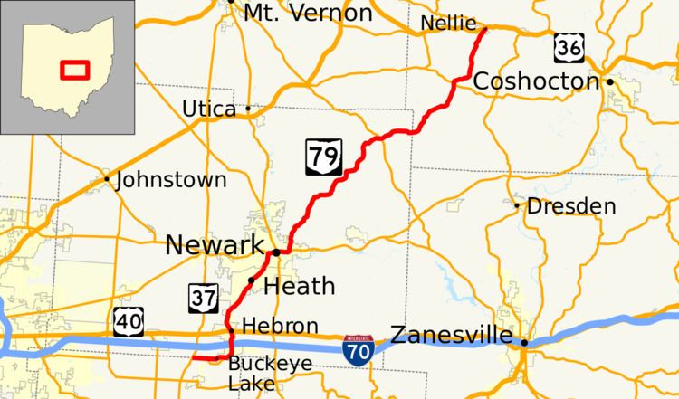 | ||
State Route 79 (SR 79) is a north–south highway that traverses Central Ohio, extending from Buckeye Lake at SR 37 to Nellie at US 36. SR 79 serves Newark, providing direct-access from Downtown Newark to I-70.
Contents
Map of OH-79, Ohio, USA
History
SR 79 was first designated between Lancaster and Walhonding in 1924 by way of Hebron, Newark, and Newcastle. By 1926, the northern terminus had been rerouted to Nellie. In 1932, the segment between Lancaster and Hebron was deleted (the part not concurrent with US 40 became SR 37) but within one year, the route was extended about 1 1⁄2 miles (2.4 km) south to Buckeye Lake ending at SR 157. In 1959, SR 79 took over most of the routing of SR 157 to end at SR 37, its current southern terminus. This extension occurred around the same time of the completion of I-70 in the area. Except for reroutings onto expressways in Hebron and Newark, the route has not experienced any other major changes.
Until 2005, State Route 79 Alternate (SR 79A) was a 1.72-mile-long (2.77 km) alternate route of SR 79. SR 79A split from SR 79 south of Hebron. SR 79 bypasses Hebron to the east, while SR 79A, or Business Route 79, ran through downtown Hebron as High Street. SR 79A followed High Street as it intersected Enterprise Drive, which ended as SR 79A, at SR 79 north of Hebron.