
Existed: 1938 – present Constructed 1938 | Length 24.03 km | |
 | ||
Counties | ||
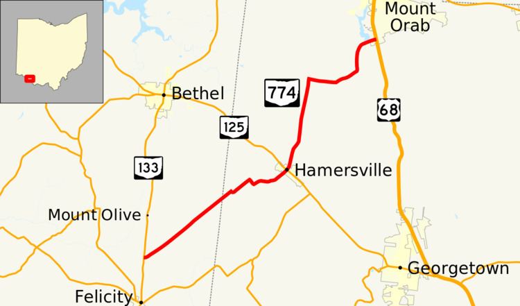
State Route 774 (SR 774) is an east–west state highway in the southwestern part of the U.S. state of Ohio. The route runs from its western terminus at SR 133 approximately 2 miles (3.2 km) north of Felicity to its eastern terminus at US 68 nearly 2 miles (3.2 km) south of Mount Orab.
Contents
Map of OH-774, Ohio, USA
Route description
Along its way, SR 774 traverses portions of eastern Clermont County and western Brown County. No portion of this highway is included within the National Highway System, a network of routes considered to be most important for the country's economy, mobility and defense.
History
SR 774 was designated in 1938. Originally, the highway ran from its present western terminus at State Route 133 north of Felicity to its junction with SR 125 in Hamersville. One year later, the highway was extended northeasterly to its present eastern terminus at US 68 south of Mount Orab.