
Existed: 1942 – present Length 26.89 km | Constructed 1942 | |
 | ||
Counties | ||
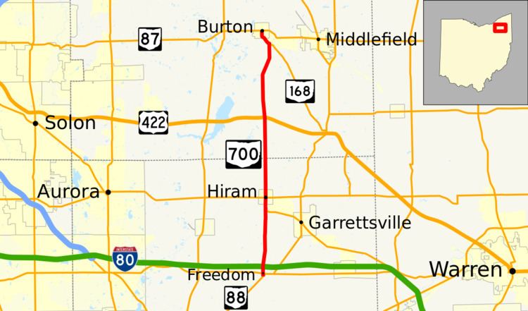
State Route 700 (SR 700) is a 16.71-mile (26.89 km) long north–south state highway in the northeastern portion of the U.S. state of Ohio. The southern terminus of SR 700 is at SR 88 about 5 miles (8.0 km) south of Hiram. Its northern terminus is at a traffic circle where it meets SR 87 in Burton, a point that doubles as the northern terminus of SR 168.
Contents
Map of OH-700, Ohio, USA
Route description
Along its path, SR 700 passes through northern Portage County and southern Geauga County. No portion of this highway is included within the National Highway System (NHS). The NHS is a network of routes deemed to be most important for the economy, mobility and defense of the nation.
History
The SR 700 designation was applied in 1942. It has utilized the same routing through Portage and Geauga Counties since its inception, when it replaced a former portion of SR 80. The highway has been paved for its entire lifespan.