
Existed: 1937 – present Length 12.1 km | North end: SR 32 near Albany Constructed 1937 | |
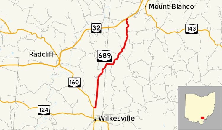 | ||
State Route 689 (SR 689) is a north–south state highway in the southern portion of the U.S. state of Ohio. Its southern terminus is at SR 160 a mile north of Wilkesville, and its northern terminus is at SR 32 about 6 miles (9.7 km) southwest of Albany.
Contents
Map of OH-689, Albany, OH 45710, USA
Route description
SR 689 passes through two counties along its path, Vinton and Meigs. This state highway is not included within the National Highway System.
History
SR 689 first appeared in 1937 along the routing that it currently occupies. Originally, its northern terminus was at a two-lane SR 346, the predecessor to SR 32. In the early 1970s, the construction of the Appalachian Highway (originally numbered SR 346 at its completion, later renumbered to SR 32) truncated the highway very slightly at its northern terminus. No other major changes have occurred to the routing since then.