
Existed: 1924 – present Length 136.4 km | Constructed 1924 | |
 | ||
Counties | ||
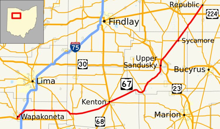
State Route 67 (SR 67) is an east–west state highway in the U.S. state of Ohio. Its western terminus is at an interchange with U.S. Route 33 (US 33) just south of Wapakoneta, which is also the southern terminus for both SR 198 and SR 501, and its eastern terminus is at SR 18 and SR 19 in Republic.
Contents
Map of OH-67, Ohio, USA
Route description
The portion of SR 67 in Wayne Township, Auglaize County, beginning at Santa Fe Line Road, passing into Waynesfield to its merge with SR 196, then leaving Waynesfield and ending at its split from SR 196, is designated as the "Staff Sgt. Sonny Zimmerman Memorial Highway", in honor of a Waynesfield resident and Waynesfield-Goshen High School graduate who was killed in Mushaka, Afghanistan on July 16, 2013, while serving in the Army.
History
References
Ohio State Route 67 Wikipedia(Text) CC BY-SA