
Founded February 3, 1845 Population 22,447 (2013) | Website www.co.wyandot.oh.us | |
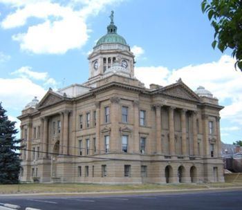 | ||
Points of interest Basilica and National, Harrison Smith Park, Indian Trail Caverns | ||
Wyandot County is a county located in the U.S. state of Ohio. As of the 2010 census, the population was 22,615. Its county seat is Upper Sandusky. Its name comes from the Wyandot Indians and is variously translated from their language as "around the plains" and "dwellers on the peninsula".
Contents
- Map of Wyandot County OH USA
- Geography
- Adjacent counties
- 2000 census
- 2010 census
- Government
- City
- Census designated place
- Notable people
- Notable places activities and events
- References
Map of Wyandot County, OH, USA
It was formed from parts of Crawford, Marion, Hardin and Hancock Counties on February 3rd, 1845.
Geography
According to the U.S. Census Bureau, the county has a total area of 408 square miles (1,060 km2), of which 407 square miles (1,050 km2) is land and 0.7 square miles (1.8 km2) (0.2%) is water.
Adjacent counties
2000 census
As of the census of 2000, there were 22,908 people, 8,882 households, and 6,270 families residing in the county. The population density was 56 people per square mile (22/km²). There were 9,324 housing units at an average density of 23 per square mile (9/km²). The racial makeup of the county was 97.91% White, 0.14% Black or African American, 0.08% Native American, 0.50% Asian, 0.74% from other races, and 0.62% from two or more races. 1.46% of the population were Hispanic or Latino of any race. 45.6% were of German, 19.5% American, 7.0% English and 6.9% Irish ancestry according to Census 2000.
There were 8,882 households out of which 33.10% had children under the age of 18 living with them, 57.90% were married couples living together, 9.20% had a female householder with no husband present, and 29.40% were non-families. 25.40% of all households were made up of individuals and 11.70% had someone living alone who was 65 years of age or older. The average household size was 2.53 and the average family size was 3.03.
In the county, the population was spread out with 25.80% under the age of 18, 8.20% from 18 to 24, 27.90% from 25 to 44, 22.70% from 45 to 64, and 15.40% who were 65 years of age or older. The median age was 37 years. For every 100 females there were 95.10 males. For every 100 females age 18 and over, there were 92.50 males.
The median income for a household in the county was $38,839, and the median income for a family was $45,173. Males had a median income of $31,716 versus $22,395 for females. The per capita income for the county was $17,170. About 3.80% of families and 5.50% of the population were below the poverty line, including 5.20% of those under age 18 and 5.10% of those age 65 or over.
2010 census
As of the 2010 United States Census, there were 22,615 people, 9,091 households, and 6,236 families residing in the county. The population density was 55.6 inhabitants per square mile (21.5/km2). There were 9,870 housing units at an average density of 24.3 per square mile (9.4/km2). The racial makeup of the county was 96.9% white, 0.6% Asian, 0.2% American Indian, 0.2% black or African American, 1.1% from other races, and 1.0% from two or more races. Those of Hispanic or Latino origin made up 2.2% of the population. In terms of ancestry, 43.3% were German, 11.8% were American, 11.2% were Irish, and 8.6% were English.
Of the 9,091 households, 32.1% had children under the age of 18 living with them, 53.2% were married couples living together, 10.2% had a female householder with no husband present, 31.4% were non-families, and 26.5% of all households were made up of individuals. The average household size was 2.46 and the average family size was 2.95. The median age was 40.5 years.
The median income for a household in the county was $47,216 and the median income for a family was $57,461. Males had a median income of $40,320 versus $30,027 for females. The per capita income for the county was $22,553. About 4.6% of families and 8.2% of the population were below the poverty line, including 11.0% of those under age 18 and 8.2% of those age 65 or over.
Government
Wyandot County is represented in the Ohio General Assembly by state Representative Wes Goodman who replaced Jeff McClain, former Wyandot County Auditor, and state Senator Dave Burke. McClain represents the 82nd Ohio House district, which also includes all of Crawford County and part of northern Marion County, having served in the Ohio House since his election in November 2008. Burke represents the 26th Ohio Senate district, which includes parts or all of eight counties currently, having been appointed to the seat in July 2011.
Wyandot County has three county commissioners who oversee the various county departments. Current commissioners are: Ron Metzger, Steven Seitz and Bill Clinger.
City
Census-designated place
Notable people
Notable places, activities, and events
The largest solar energy farm in Ohio covers 80 acres (320,000 m2) adjacent to the Wyandot County Airport. It has 159,000 ground-mounted solar panels, and can produce 12 megawatts. It was inaugurated on 19 August 2010, with Governor Ted Strickland. It was developed by PSEG Energy.