
Existed: 1987 – present Counties: Stark Constructed 1987 | Length 7.66 km | |
 | ||
West end: US 30 / US 62 in Massillon | ||
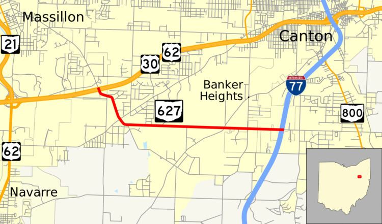
State Route 627 (SR 627) is an east–west state highway in the northeastern portion of the U.S. state of Ohio. SR 627's western terminus is at a diamond interchange with the US 30/US 62 freeway about 1.50 miles (2.41 km) southeast of Massillon. Its eastern terminus is also at a diamond interchange, this time with I-77 at its Exit 101 in far southern Canton.
Contents
Map of OH-627, Canton, OH 44706, USA
Route description
The entire routing of SR 627 is situated in the western portion of Stark County. SR 627 is not a part of the National Highway System, a system of routes considered to be most important for the economy, mobility and defense of the nation.
History
SR 627 was established in 1987 along the routing between the US 30/US 62 and I-77 freeways that it utilizes to this day. The route has not experienced any major changes to its alignment since its inception.
Major intersections
The entire route is in Stark County.