
Existed: 1937 – present Counties: Washington Constructed 1937 | Length 12.65 km | |
 | ||
East end: SR 821 near Lower Salem | ||
Ohio state route 530 twisty
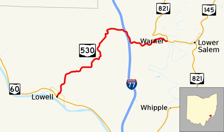
State Route 530 (SR 530) is a nearly 8-mile (13 km) long, east-west state highway in the southeastern corner of the U.S. state of Ohio. The western terminus of State Route 530 is at a signalized T-intersection with State Route 60 in downtown Lowell. Its eastern terminus is at State Route 821 in the community of Warner, nearly 1 mile (1.6 km) west of Lower Salem.
Contents
- Ohio state route 530 twisty
- Map of OH 530 Lowell OH 45744 USA
- Route description
- History
- Major intersections
- References
Map of OH-530, Lowell, OH 45744, USA
Established in the late 1930s, State Route 530 exists entirely within Washington County, passing through rural northern portions of the county while connecting the Lowell with the Lower Salem vicinity.
Route description
All of State Route 530 is situated within the northern part of Washington County. The highway is not included as a component of the National Highway System.
History
The designation of State Route 530 took place in 1937. From its inception, State Route 530 has been routed along the same alignment that it utilizes today. No major changes have taken place to the routing of State Route 530 since it was established.
Major intersections
The entire route is in Washington County.