Harman Patil (Editor)

Ohio State Route 45

Updated on
Edit
Like
Comment
Share on FacebookTweet on TwitterShare on LinkedInShare on Reddit
Existed:
  
1924 – present

Length
  
155.5 km

North end:
  
SR 531 near Ashtabula

Constructed
  
1924

Ohio State Route 45

South end:
  
SR 7 / SR 39 in Wellsville

Counties
  
Columbiana County, Ohio, Mahoning County, Ohio, Trumbull County, Ohio, Ashtabula County, Ohio

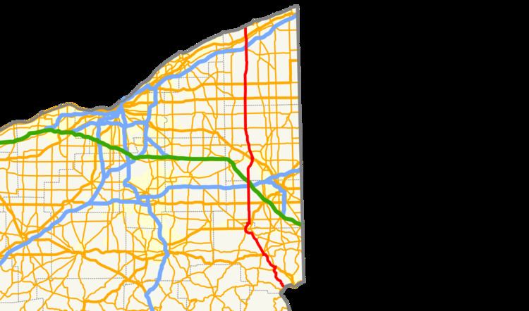
State Route 45 (SR 45) is a north–south state highway in the northeastern portion of the U.S. state of Ohio. Its southern terminus is at the State Route 7/State Route 39 concurrency in Wellsville, and its northern terminus is at State Route 531 about 3 miles (4.8 km) west of Ashtabula.

History

  • 1924 – Original route established; originally routed from Lisbon to Geneva along its current route from Lisbon to 1½ miles south of Salem, from 1½ miles south of Salem to 1½ miles north of Salem on a currently unnumbered road, along its current route from 1½ miles north of Salem to North Bloomfield, from North Bloomfield to Windsor on a currently unnumbered road, and from Windsor to Geneva along current State Route 534.
  • 1931 – By this time, rerouted from North Bloomfield to Orwell along a previously unnumbered road, and from Orwell to Windsor along U.S. Route 322; original routing from North Bloomfield to Windsor decertified.
  • 1932 – Extended to Wellsville along the former alignment of State Route 153 from Wellsville to West Point, and along U.S. Route 30 (formerly State Route 5 before 1926) from West Point to Lisbon.
  • 1938 – Rerouted north from Orwell to its current northern terminus; former alignment from Windsor to Geneva certified as State Route 534.
  • 1976 – Routed around Salem on newly completed bypass (southwest portion completed in 1972; bypass certified as State Route 45B in 1974).
  • 1997 – From Lisbon to State Route 558 upgraded to divided highway.
  • References

    Ohio State Route 45 Wikipedia