
Existed: 1932 – present Length 38.3 km | Constructed 1932 | |
 | ||
Counties | ||
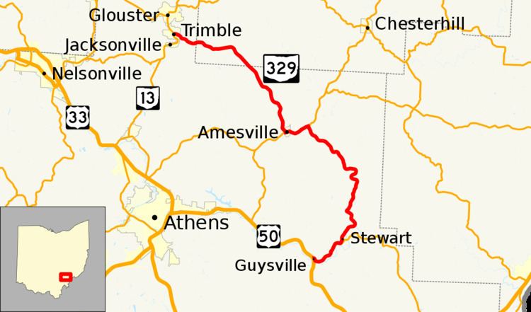
State Route 329 (SR 329) is a state highway located in southeastern Ohio. The route is signed as a north–south route though the shape of the road is more of a backwards C. The southern terminus of SR 329 is in the Rome Township community of Guysville at US 50 and SR 32. After traveling north through the Athens County communities of Stewart and Amesville, the route briefly enters Morgan County before re-entering Athens County and ending at SR 13 in the village of Trimble.
Contents
Map of OH-329, Ohio, USA
History
SR 329 was certified and paved in 1932, originally routed from Guysville to Stewart, in southeast Ohio. In 1937, the route was extended from Stewart to US 50 Alternate, 2 miles (3.2 km) east of Amesville. In 1962, the highway was extended to Trimble, passing through Amesville and using the former route of SR 280.